Police Helicopter to MOD St Athan, MOD St Athan
Friday, 27 February 2026 | 11:15 | From Pen Tranch
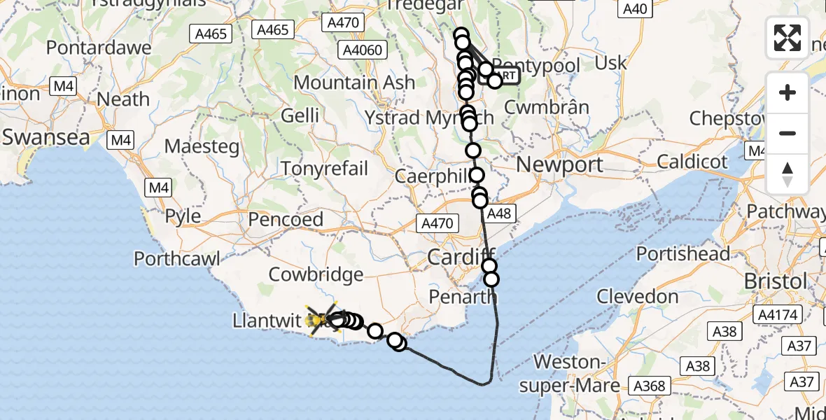
On Friday, 27 February 2026 at 11:15, a Police Helicopter departed from Pen Tranch to MOD St Athan. It was the Police Helicopter with registration number G-NWOI. The flight lasted 22 minutes. During that period, the aircraft travelled 59 miles at an average speed of 158 miles per hour at a maximum altitude of 3175 feet.

Helicopter: G-NWOI
The helicopter G-NWOI is used by the British police. The helicopter is deployed in pursuits, missing persons cases and other incidents where a helicopter provides added value.
Photo: James from Cheltenham
59 miles
3175 feet
158 mph
23 minutes
11:15
11:37

Route
MOD St Athan, St Athan, Vale of Glamorgan11:37
Flemingston11:37
West Aberthaw11:36
Llancarfan11:36
Penmark11:36
Barry11:36
Cardiff International Airport, Cardiff11:35
Rhoose11:34
Barry11:34
Bristol Channel11:25
Tremorfa11:24
Cardiff11:22
Pontprennau11:22
Rudry11:21
Machen11:20
Wattsville11:19
West End11:19
Pontllanfraith11:18
Newbridge11:18
Croespen-maen11:17
Croespen-maen, Caerphilly11:17
Croespen-maen11:17
Pentwyn11:16
Argoed11:16
Hafodyrynys11:16
Aberbeeg11:15
Hafodyrynys11:15
Cwm11:15
Pen Tranch, 11:15
Live flights
Today
Helicopter flights on your website?
You can easily display helicopter flights on your own website. Use the embed code.
