Police Helicopter to Redhill Aerodrome, Redhill Aerodrome
Thursday, 26 February 2026 | 22:18 | From Rudgwick
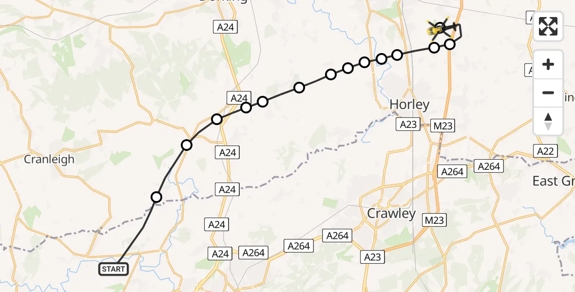
On Thursday, 26 February 2026 at 22:18, a Police Helicopter departed from Rudgwick to Redhill Aerodrome. It was the Police Helicopter with registration number G-POLH. The flight lasted 7 minutes. During that period, the aircraft travelled 19 miles at an average speed of 153 miles per hour at a maximum altitude of 1200 feet.
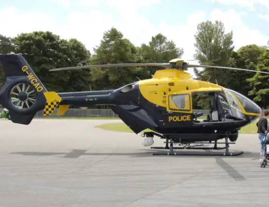
Helicopter: G-POLH
The helicopter G-POLH is used by the British police. The helicopter is deployed in pursuits, missing persons cases and other incidents where a helicopter provides added value.
Photo: Arpingstone
19 miles
1200 feet
153 mph
8 minutes
22:18
22:26

Route
Redhill Aerodrome, Redhill, Surrey22:26
Redhill Aerodrome, Redhill, Surrey22:26
South Nutfield22:25
Reigate and Banstead22:24
Salfords, Reigate and Banstead22:24
Reigate and Banstead22:24
Norwood Hill, Reigate and Banstead22:23
Mole Valley22:23
Norwood Hill, Mole Valley22:23
Mole Valley22:22
Newdigate, Mole Valley22:22
Beare Green, Mole Valley22:21
Capel, Mole Valley22:21
Ockley, Mole Valley22:20
Okewood Hill, Mole Valley22:20
Guildford Road, Horsham22:18
Today
Police Helicopter to Epping Forest, Green Lane26 Feb 23:43
Flights Rudgwick
Helicopter flights on your website?
You can easily display helicopter flights on your own website. Use the embed code.
