Coastguard Helicopter to Killin, Auchlyne Road
Thursday, 26 February 2026 | 16:20 | From Loch Tay
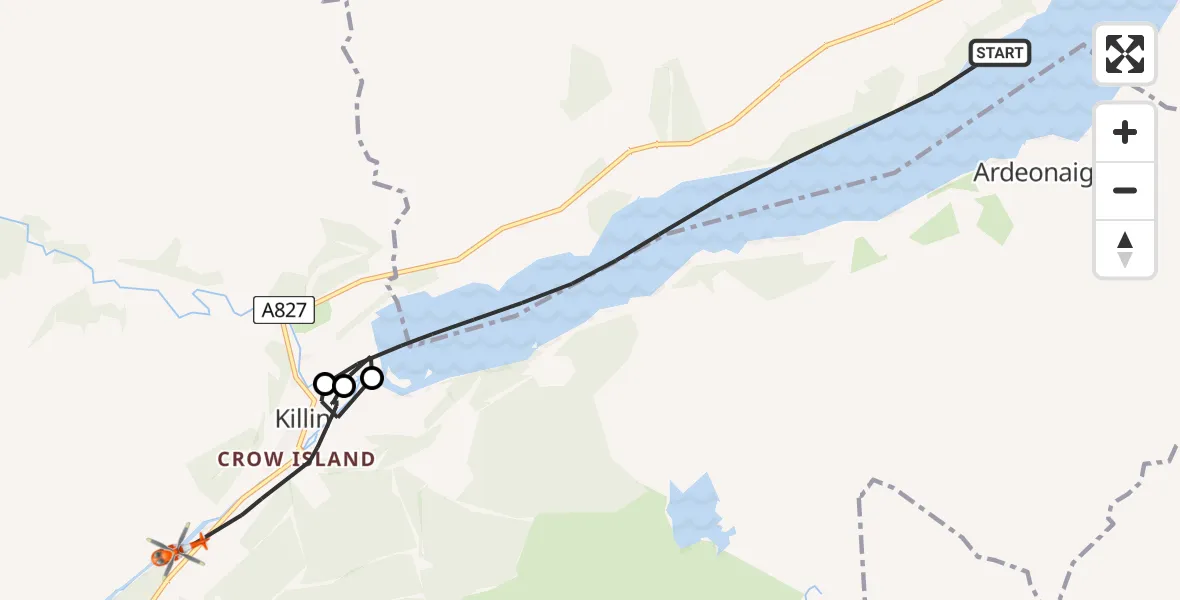
On Thursday, 26 February 2026 at 16:20, a Coastguard Helicopter departed from Loch Tay to Killin. It was the Coastguard Helicopter with registration number G-MCGX. The flight lasted 27 minutes. During that period, the aircraft travelled 9 miles at an average speed of 22 miles per hour at a maximum altitude of 1325 feet.

Helicopter: G-MCGX
The helicopter G-MCGX is used by the British Coastguard. The helicopter is deployed in search and rescue operations at sea, rescue operations involving ships or drilling platforms, patrols to prevent smuggling or piracy, environmental monitoring and disaster relief support.
Photo: Nick (UK)
10 miles
1325 feet
22 mph
27 minutes
16:20
16:46

Route
Auchlyne Road, 16:46
Lyon Road, 16:44
Lyon Road, 16:28
Lyon Road, 16:27
Killin16:25
Loch Tay16:24
Killin16:24
Loch Tay, 16:20
Live flights
Today
Flights Killin
Coastguard Helicopter to Tomochrocher22 Jun 16:12
Coastguard Helicopter to Killin, Stirling22 Jun 14:48
Coastguard Helicopter to Killin, Stirling22 Jun 14:24
Coastguard Helicopter to Killin, Stirling22 Jun 14:14
Coastguard Helicopter to Milton24 May 16:58
Coastguard Helicopter to Killin24 May 15:56
Coastguard Helicopter to Killin, Lyon Road24 May 15:52
Coastguard Helicopter to Killin, Lyon Road24 May 15:34
Coastguard Helicopter to Killin, Lyon Road24 May 13:00
Helicopter flights on your website?
You can easily display helicopter flights on your own website. Use the embed code.
