Air Ambulance Helicopter to Newcastle Royal Victoria Infirmary
Thursday, 26 February 2026 | 10:34 | From Framwellgate Moor
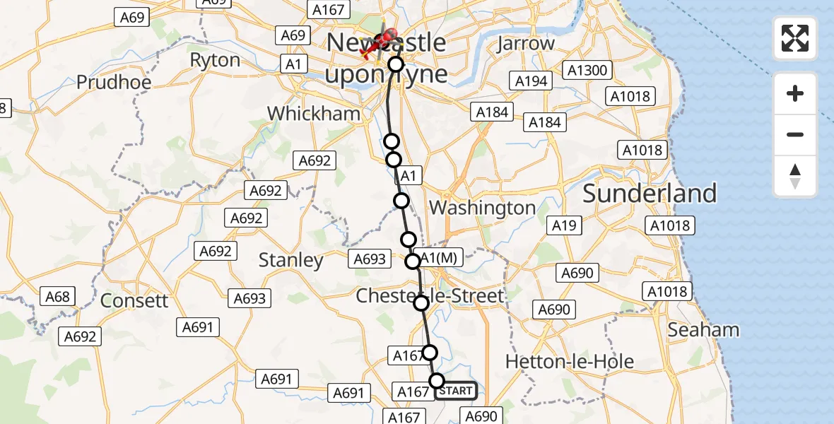
On Thursday, 26 February 2026 at 10:34, a Air Ambulance Helicopter departed from Framwellgate Moor to Newcastle Royal Victoria Infirmary. It was the Air Ambulance Helicopter with registration number G-NHAE. The flight lasted 9 minutes. During that period, the aircraft travelled 14 miles at an average speed of 95 miles per hour at a maximum altitude of 1425 feet.
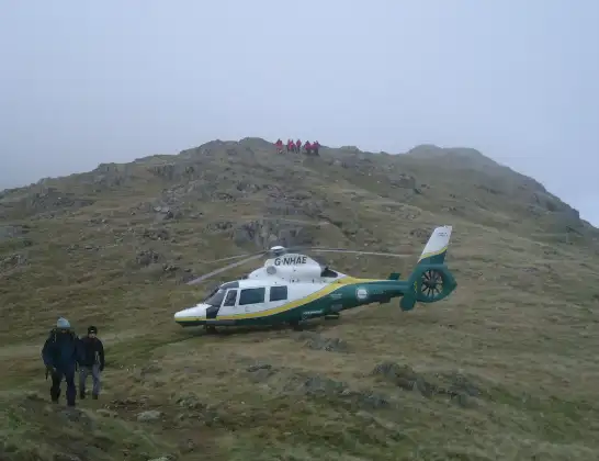
Helicopter: G-NHAE
The helicopter G-NHAE is used as a air ambulance helicopter. The main purpose of this aircraft is to transport a Mobile Medical Team to an incident as quickly as possible, enabling the trauma doctor to provide immediate first aid on site. The aircraft is flying this flight as Air Ambulance Helicopter.
Photo: Michael Earnshaw
15 miles
1425 feet
95 mph
9 minutes
10:34
10:43

Route
Newcastle Royal Victoria Infirmary, Newcastle upon Tyne10:43
Newcastle Royal Victoria Infirmary, Newcastle upon Tyne10:43
Newcastle Royal Victoria Infirmary, Newcastle upon Tyne10:41
Newcastle Royal Victoria Infirmary, Newcastle upon Tyne10:40
Newcastle upon Tyne, North East10:39
Gateshead, North East10:38
Lamesley, Birtley10:38
Lamesley, Gateshead10:38
Ouston, North East10:37
High Flats Farm Airstrip10:37
South Pelaw, Chester-le-Street10:36
Chester Moor, Chester-le-Street10:36
Pity Me, North East10:35
Framwellgate Moor, North East10:34
Live flights
Today
Police Helicopter to Manchester Barton Aerodrome13 Jul 23:56
Police Helicopter to Bournemouth Airport13 Jul 23:55
Air Ambulance Helicopter to Cardiff Heliport13 Jul 23:38
Police Helicopter to Harborough, Sulby Road13 Jul 23:36
Police Helicopter to Birmingham Airport13 Jul 23:21
Helicopter flights on your website?
You can easily display helicopter flights on your own website. Use the embed code.
