Air Ambulance Helicopter to Melton Mowbray, Mayfield Street
Thursday, 26 February 2026 | 7:29 | From Rushcliffe
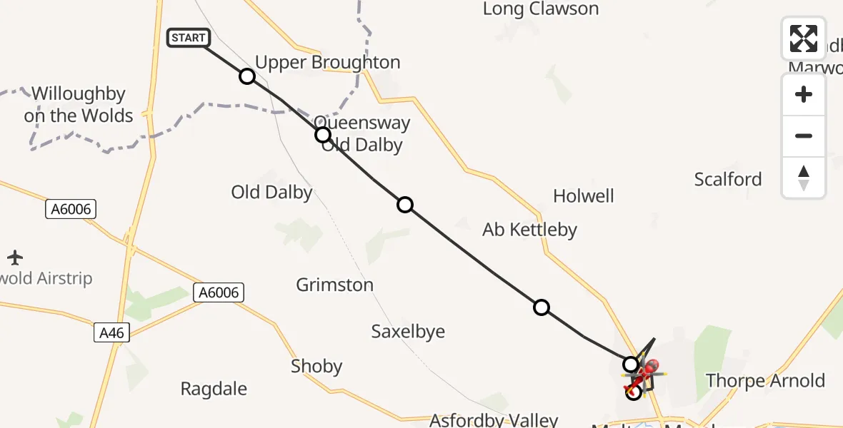
On Thursday, 26 February 2026 at 7:29, a Air Ambulance Helicopter departed from Rushcliffe to Melton Mowbray. It was the Air Ambulance Helicopter with registration number G-DRLA. The flight lasted 4 minutes. During that period, the aircraft travelled 9 miles at an average speed of 131 miles per hour at a maximum altitude of 1125 feet.
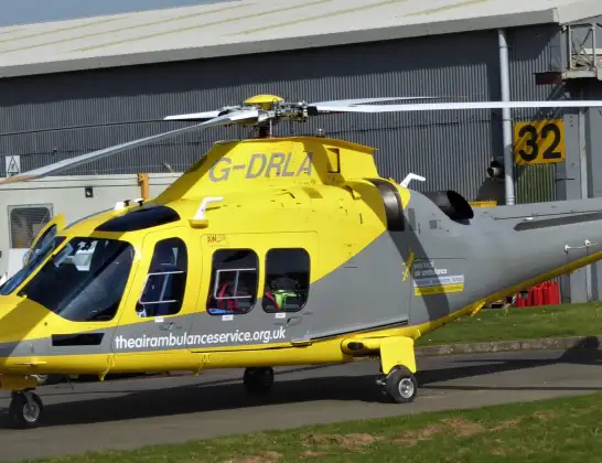
Helicopter: G-DRLA
The helicopter G-DRLA is used as an ambulance helicopter. The helicopter is equipped with a stretcher for transporting patients. The helicopter is often used to transport to hospitals.
Photo: Alec Wilson
9 miles
1125 feet
131 mph
5 minutes
07:29
07:33

Route
Mayfield Street, Melton07:33
Melton Mowbray, Melton07:32
Sysonby, Melton07:32
Melton Mowbray, Melton07:31
Ab Kettleby, Melton07:30
Queensway Old Dalby, Melton07:29
Upper Broughton, Rushcliffe07:29
Folly Hall Lane, East Midlands07:29
Live flights
Today
Flights Rushcliffe
Air Ambulance Helicopter to Rushcliffe, A461 Jul 18:42
Air Ambulance Helicopter to Ashwell, Oakham30 Jun 12:44
Air Ambulance Helicopter to Rushcliffe, A4629 Jun 11:54
Air Ambulance Helicopter to East Carlton, A42727 Jun 11:00
Helicopter flights on your website?
You can easily display helicopter flights on your own website. Use the embed code.
