Air Ambulance Helicopter to Blackburn, Park Lee Road
Tuesday, 24 February 2026 | 11:58 | From Blackpool Airport
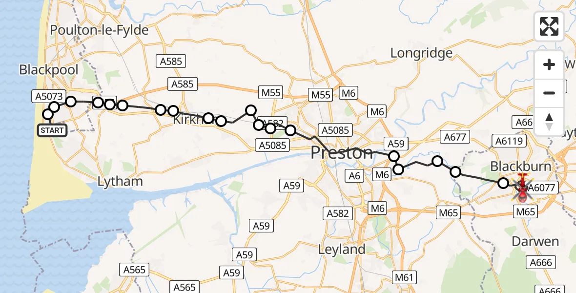
On Tuesday, 24 February 2026 at 11:58, a Air Ambulance Helicopter departed from Blackpool Airport to Blackburn. It was the Air Ambulance Helicopter with registration number G-NWAA. The flight lasted 12 minutes. During that period, the aircraft travelled 29 miles at an average speed of 141 miles per hour at a maximum altitude of 1575 feet.
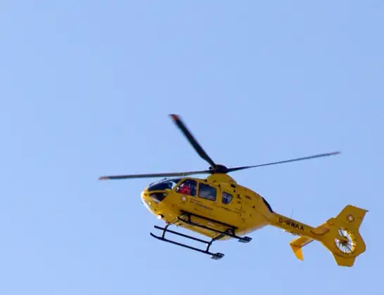
Helicopter: G-NWAA
The helicopter G-NWAA is used as a air ambulance helicopter. The main purpose of this aircraft is to transport a Mobile Medical Team to an incident as quickly as possible, enabling the trauma doctor to provide immediate first aid on site. The aircraft is flying this flight as Air Ambulance Helicopter.
Photo: David P Howard
29 miles
1575 feet
141 mph
13 minutes
11:58
12:11

Route
Park Lee Road, Lancashire12:11
Blackburn, Lancashire12:08
Pleasington, Lancashire12:07
South Ribble, Lancashire12:07
Coupe Green, South Ribble12:06
Samlesbury, South Ribble12:06
Preston, Lancashire12:04
Lea Town, Preston12:03
Clifton, Fylde12:03
Fylde, Lancashire12:03
Newton-with-Scales, Fylde12:02
Treales, Fylde12:02
Wesham, Kirkham12:01
Wrea Green, Fylde12:01
Great Plumpton, Fylde12:00
Fylde, Lancashire12:00
Mereside, Lancashire12:00
Blackpool, Lancashire11:59
South Shore, Lancashire11:59
Squires Gate, Lancashire11:59
Martin Avenue, Lancashire11:58
Live flights
Police Helicopter on its way from Dundrod12 Jul 22:50
Today
Police Helicopter to East Ardsley, Stoney Lane12 Jul 23:51
Police Helicopter to Birmingham Airport12 Jul 23:46
Air Ambulance Helicopter to Newlands of Culloden12 Jul 23:24
Flights Blackburn
Police Helicopter to Hawarden Airport11 Jul 17:00
Police Helicopter to Blackburn, Queens Road11 Jul 16:20
Air Ambulance Helicopter to Blackpool Airport21 Jun 20:33
Police Helicopter to Manchester Barton Aerodrome18 Jun 16:31
Police Helicopter to Blackburn, Montague Street18 Jun 16:19
Air Ambulance Helicopter to Blackpool Airport14 Jun 14:42
Air Ambulance Helicopter to Blackpool Airport23 May 13:31
Helicopter flights on your website?
You can easily display helicopter flights on your own website. Use the embed code.
