to MOD St Athan, MOD St Athan
Monday, 23 February 2026 | 13:04 | From Eglwys Brewis
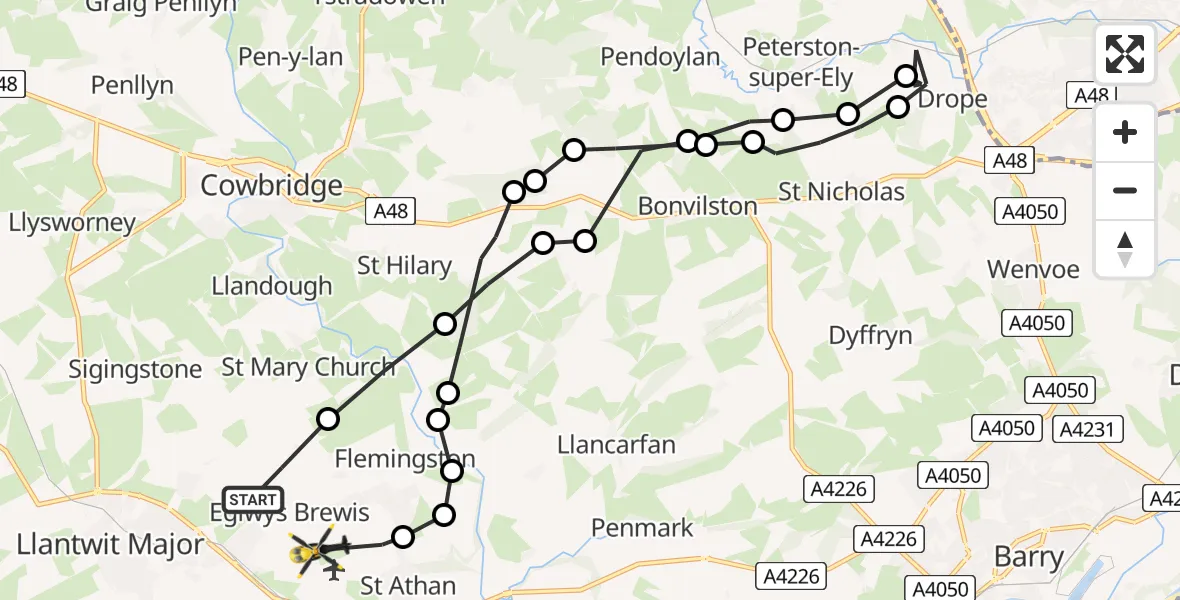
On Monday, 23 February 2026 at 13:04, a Police Helicopter departed from Eglwys Brewis to MOD St Athan. It was the Police Helicopter with registration number G-NWOI. The flight lasted 10 minutes. During that period, the aircraft travelled 19 miles at an average speed of 116 miles per hour at a maximum altitude of 850 feet.

Helicopter: G-NWOI
The helicopter G-NWOI is used by the British police. The helicopter is deployed in pursuits, missing persons cases and other incidents where a helicopter provides added value.
Photo: Alec Wilson
19 miles
850 feet
116 mph
10 minutes
13:04
13:14

Route
MOD St Athan, St Athan, Vale of Glamorgan13:14
MOD St Athan, St Athan, Vale of Glamorgan13:13
Flemingston13:13
St. Athan13:13
Llancarfan13:13
Llanfair13:13
St Hilary13:12
Welsh St. Donats13:11
Bonvilston13:11
Pendoylan13:10
Peterston-super-Ely13:10
St Nicholas13:09
Drope13:08
St Nicholas13:07
Peterston-super-Ely13:07
Pendoylan13:07
Bonvilston13:06
Llancarfan13:06
St Hilary13:05
St Mary Church13:05
Eglwys Brewis, 13:04
Live flights
Police Helicopter on its way from South Nutfield26 Feb 23:55
Today
Police Helicopter to Epping Forest, Green Lane26 Feb 23:43
Helicopter flights on your website?
You can easily display helicopter flights on your own website. Use the embed code.
