Police Helicopter to MOD St Athan
Monday, 23 February 2026 | 10:46 | From Bargoed
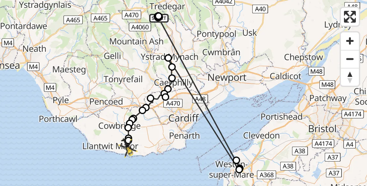
On Monday, 23 February 2026 at 10:46, a Police Helicopter departed from Bargoed to MOD St Athan. It was the Police Helicopter with registration number G-NWOI. The flight lasted 31 minutes. During that period, the aircraft travelled 85 miles at an average speed of 165 miles per hour at a maximum altitude of 2000 feet.

Helicopter: G-NWOI
The helicopter G-NWOI is used by the British police. The helicopter is deployed in pursuits, missing persons cases and other incidents where a helicopter provides added value.
Photo: Alec Wilson
85 miles
2000 feet
165 mph
31 minutes
10:46
11:16

Route
MOD St Athan, St Athan, Vale of Glamorgan11:16
Flemingston11:16
Llanfair11:16
St Hilary11:15
Aberthin11:14
Pendoylan11:14
Welsh St. Donats11:14
Pendoylan11:13
Peterston-super-Ely11:12
Cardiff11:11
Gwaelod-y-garth11:10
Taffs Well11:10
Nantgarw11:10
Caerphilly11:09
Llanbradach and Pwllypant11:08
Hengoed, Ystrad Mynach11:07
Weston-super-Mare11:05
Worle, Weston-super-Mare11:02
Sand Bay11:01
Worle, Weston-super-Mare10:57
Bargoed10:52
Pontlottyn10:52
Bargoed10:51
Pontlottyn10:51
Bargoed10:51
Pontlottyn10:51
Bargoed10:49
Pontlottyn10:48
Bargoed10:47
Pontlottyn10:46
Pidwelt Rise, 10:46
Live flights
Today
Flights Bargoed
Police Helicopter to Pengam, Gwerthonor Road30 May 18:21
Air Ambulance Helicopter to Cardiff Heliport27 Apr 11:11
Air Ambulance Helicopter to Cardiff Heliport19 Apr 12:23
Air Ambulance Helicopter to Cardiff Heliport19 Apr 12:16
Air Ambulance Helicopter to Bargoed19 Apr 11:29
Air Ambulance Helicopter to Bargoed19 Apr 11:20
Air Ambulance Helicopter to Bargoed, Angel Way19 Apr 11:09
Air Ambulance Helicopter to Bargoed, Angel Way19 Apr 11:09
Helicopter flights on your website?
You can easily display helicopter flights on your own website. Use the embed code.
