Police Helicopter to Exeter International Airport, Exeter International Airport
Sunday, 22 February 2026 | 19:41 | From Ermington
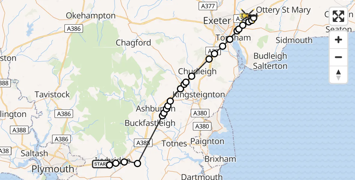
On Sunday, 22 February 2026 at 19:41, a Police Helicopter departed from Ermington to Exeter International Airport. It was the Police Helicopter with registration number G-CPAS. The flight lasted 15 minutes. During that period, the aircraft travelled 38 miles at an average speed of 158 miles per hour at a maximum altitude of 1575 feet.
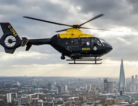
Helicopter: G-CPAS
The helicopter G-CPAS is used by the British police. The helicopter is deployed in pursuits, missing persons cases and other incidents where a helicopter provides added value.
Photo: Tony Melony
39 miles
1575 feet
158 mph
15 minutes
19:41
19:55

Route
Exeter International Airport, Exeter, Devon19:55
Rockbeare, East Devon19:54
Aylesbeare, East Devon19:54
East Devon, Devon and Torbay19:54
Clyst Honiton, East Devon19:54
Clyst St Mary, East Devon19:53
Clyst St. George, East Devon19:53
Topsham, Exeter19:52
Exminster, Teignbridge19:52
Kenn, Teignbridge19:51
Teignbridge, Devon and Torbay19:50
Chudleigh, Teignbridge19:49
Chudleigh Knighton, Teignbridge19:48
Heathfield, Teignbridge19:48
Liverton Coldeast, Teignbridge19:48
Bickington, Teignbridge19:47
Teignbridge, Devon and Torbay19:46
Ashburton, Teignbridge19:46
Well Farm Airstrip, Devon19:46
Ashburton, Teignbridge19:46
North Huish, South Hams19:43
Ugborough, South Hams19:42
South Hams, Devon and Torbay19:41
Ivybridge, South Hams19:41
Devon Expressway, South Hams19:41
Live flights
Today
Police Helicopter to Epping Forest, Green Lane26 Feb 23:43
Flights Ermington
Helicopter flights on your website?
You can easily display helicopter flights on your own website. Use the embed code.
