Coastguard Helicopter to Coleraine, Portstewart Road
Sunday, 22 February 2026 | 2:01 | From Glasgow Prestwick Airport
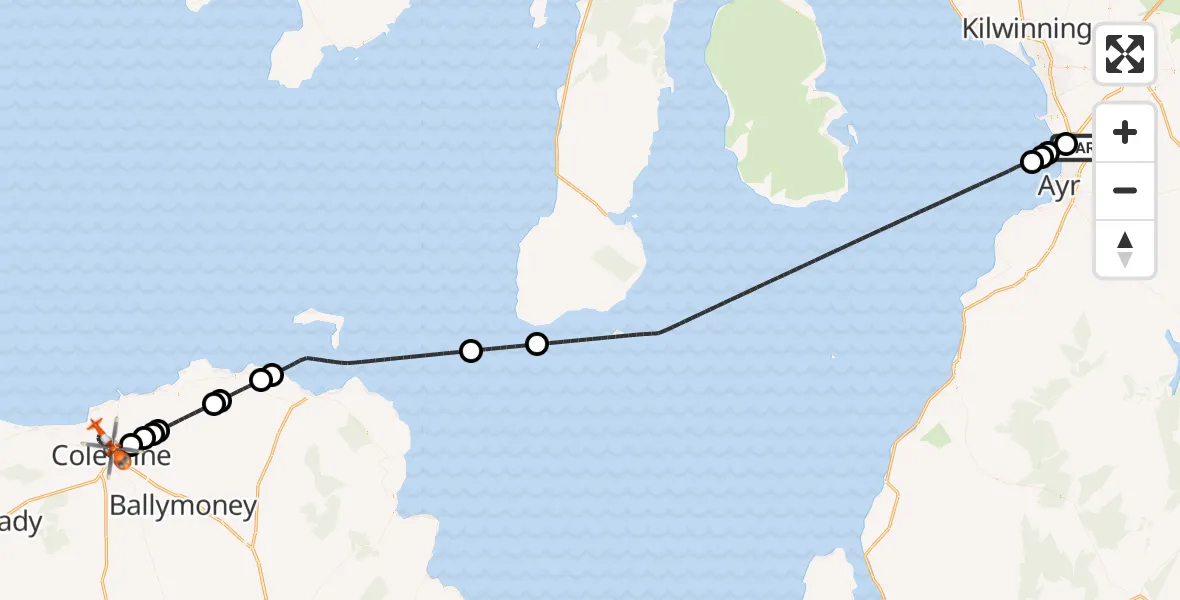
On Sunday, 22 February 2026 at 2:01, a Coastguard Helicopter departed from Glasgow Prestwick Airport to Coleraine. It was the Coastguard Helicopter with registration number G-MCGP. The flight lasted 100 minutes. During that period, the aircraft travelled 95 miles at an average speed of 57 miles per hour at a maximum altitude of 1700 feet.
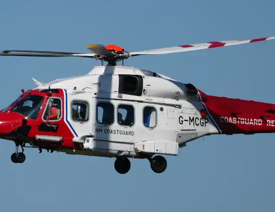
Helicopter: G-MCGP
The helicopter G-MCGP is used by the British Coastguard. The helicopter is deployed in search and rescue operations at sea, rescue operations involving ships or drilling platforms, patrols to prevent smuggling or piracy, environmental monitoring and disaster relief support.
Photo: Jonathan Payne
95 miles
1700 feet
57 mph
101 minutes
02:01
03:41

Route
Portstewart Road, Causeway Coast and Glens District03:41
Coleraine, Causeway Coast and Glens District02:42
Drumadragh, Causeway Coast and Glens District02:41
Causeway Coast and Glens District02:41
Ballybogey, Causeway Coast and Glens District02:40
Causeway Coast and Glens District02:38
Bushmills, Causeway Coast and Glens District02:38
Causeway Coast and Glens District02:36
Ballintoy, Causeway Coast and Glens District02:35
Inner Seas02:28
Irish Sea02:26
Inner Seas02:07
Troon02:06
Ayr02:06
Prestwick02:05
Glasgow Prestwick Airport, Prestwick, South Ayrshire02:04
Glasgow Prestwick Airport, Prestwick, South Ayrshire02:01
Live flights
Today
Police Helicopter to Epping Forest, Green Lane26 Feb 23:43
Flights Coleraine
Coastguard Helicopter to Inner Seas, Inner Seas22 Feb 03:43
Helicopter flights on your website?
You can easily display helicopter flights on your own website. Use the embed code.
