to Hill Croome, M5
Saturday, 21 February 2026 | 16:15 | From Ripple
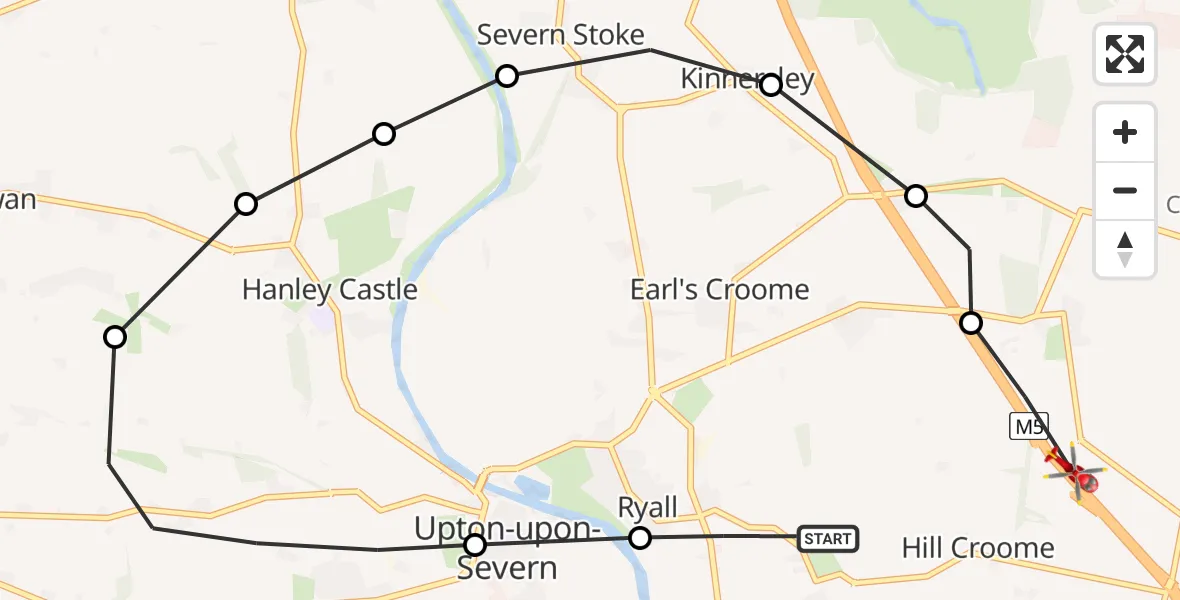
On Saturday, 21 February 2026 at 16:15, a Air Ambulance Helicopter departed from Ripple to Hill Croome. It was the Air Ambulance Helicopter with registration number G-OMAA. The flight lasted 5 minutes. During that period, the aircraft travelled 10 miles at an average speed of 124 miles per hour at a maximum altitude of 1325 feet.
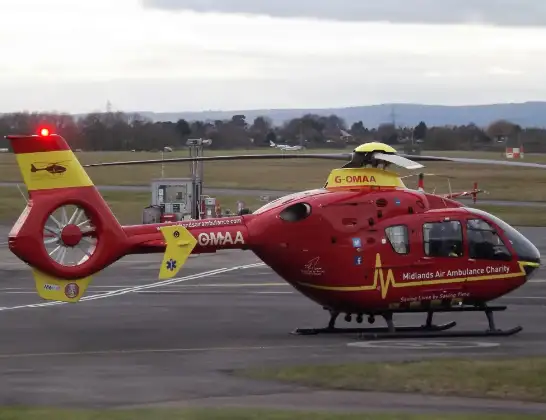
Helicopter: G-OMAA
The helicopter G-OMAA is used as a air ambulance helicopter. The main purpose of this aircraft is to transport a Mobile Medical Team to an incident as quickly as possible, enabling the trauma doctor to provide immediate first aid on site. The aircraft is flying this flight as .
Photo: James from Cheltenham, Gloucestershire
10 miles
1325 feet
124 mph
5 minutes
16:15
16:20

Route
M5, Malvern Hills16:20
Hill Croome, Malvern Hills16:20
Earl's Croome, Malvern Hills16:19
Kinnersley, Worcester16:19
Severn Stoke, Malvern Hills16:18
Hanley Castle, Malvern Hills16:18
Hanley Castle, Upton-upon-Severn16:18
Hanley Castle, Malvern Hills16:18
Upton-upon-Severn, Malvern Hills16:16
Ripple, Worcester16:16
Strensham Road, Malvern Hills16:15
Live flights
Today
Police Helicopter to Epping Forest, Green Lane26 Feb 23:43
Flights Ripple
to Hill Croome, M521 Feb 16:15
Helicopter flights on your website?
You can easily display helicopter flights on your own website. Use the embed code.
