Air Ambulance Helicopter to Towcester, Milthorpe
Saturday, 21 February 2026 | 13:24 | From Coventry Airport
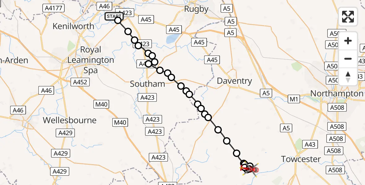
On Saturday, 21 February 2026 at 13:24, a Air Ambulance Helicopter departed from Coventry Airport to Towcester. It was the Air Ambulance Helicopter with registration number G-WNAS. The flight lasted 13 minutes. During that period, the aircraft travelled 27 miles at an average speed of 127 miles per hour at a maximum altitude of 1125 feet.
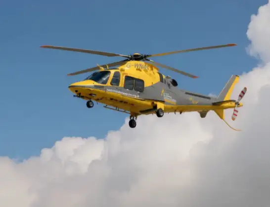
Helicopter: G-WNAS
The helicopter G-WNAS is used as an ambulance helicopter. The helicopter is equipped with a stretcher for transporting patients. The helicopter is often used to transport to hospitals.
Photo: Tony Melony
28 miles
1125 feet
127 mph
13 minutes
13:24
13:37

Route
Milthorpe, 13:37
Towcester13:36
Weedon Lois13:35
Weston13:35
Weedon Lois13:34
Weston13:34
Weedon Lois13:33
Weston13:33
Weston and Weedon13:33
Moreton Pinkney13:32
Canons Ashby13:31
Woodford Halse13:31
Charwelton13:30
Byfield13:30
Catesby13:29
Daventry13:29
Hellidon13:29
Stratford-on-Avon13:28
Priors Marston, Stratford-on-Avon13:28
Napton on the Hill, Stratford-on-Avon13:28
Tomlow Farm Airstrip13:27
Stockton CP, Stratford-on-Avon13:27
Long Itchington, Stratford-on-Avon13:27
Birdingbury CP, Rugby13:27
Marton CP, Rugby13:26
Birdingbury CP, Rugby13:26
Marton CP, Rugby13:26
Eathorpe, Warwick13:25
Princethorpe CP, Rugby13:25
Bubbenhall, Warwick13:24
Baginton, Warwick13:24
Today
Police Helicopter to Epping Forest, Green Lane26 Feb 23:43
Flights Towcester
Air Ambulance Helicopter to Towcester, Milthorpe21 Feb 13:24
Helicopter flights on your website?
You can easily display helicopter flights on your own website. Use the embed code.
