Police Helicopter to Newcastle International Airport, Newcastle International Airport
Saturday, 21 February 2026 | 10:37 | From Newcastle upon Tyne
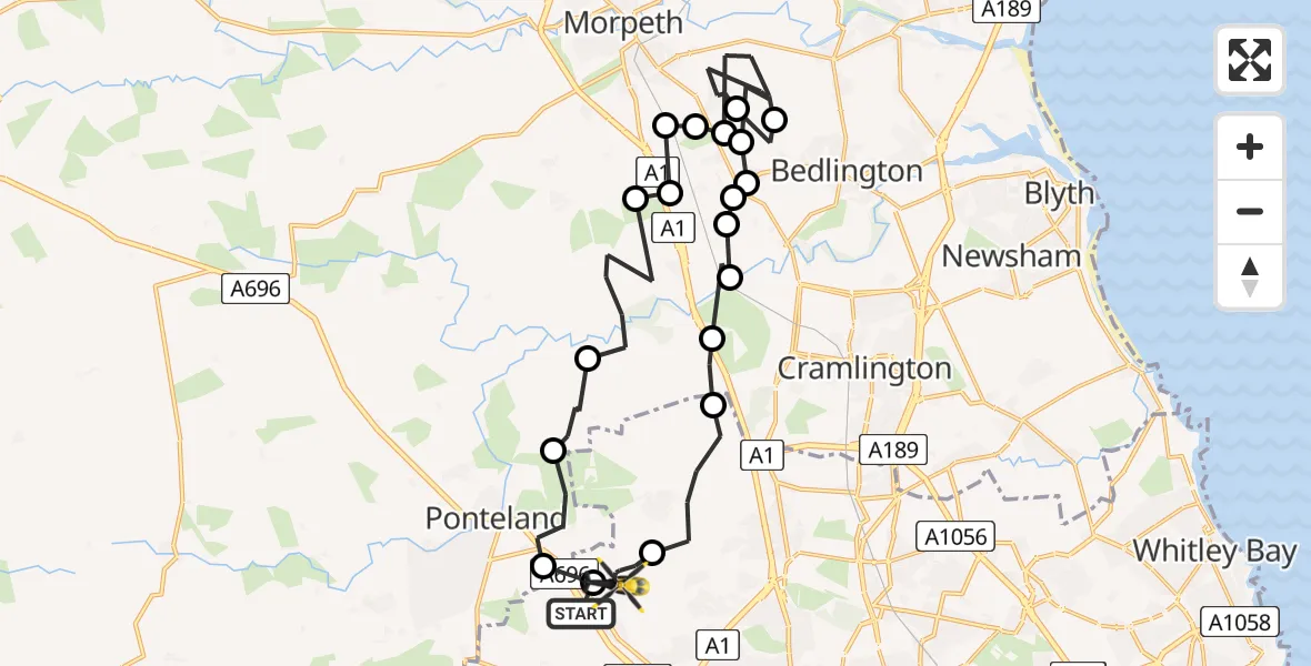
On Saturday, 21 February 2026 at 10:37, a Police Helicopter departed from Newcastle upon Tyne to Newcastle International Airport. It was the Police Helicopter with registration number G-POLA. The flight lasted 13 minutes. During that period, the aircraft travelled 29 miles at an average speed of 131 miles per hour at a maximum altitude of 1125 feet.
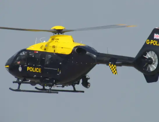
Helicopter: G-POLA
The helicopter G-POLA is used by the British police. The helicopter is deployed in pursuits, missing persons cases and other incidents where a helicopter provides added value.
Photo: ozz13x
29 miles
1125 feet
131 mph
14 minutes
10:37
10:50

Route
Newcastle International Airport, Newcastle upon Tyne, Tyne and Wear10:50
Newcastle International Airport, Newcastle upon Tyne, Tyne and Wear10:49
Dinnington, Newcastle upon Tyne10:47
Stannington, North East10:47
Hartford Bridge, North East10:46
Stannington, North East10:46
Stannington Station, North East10:46
Hartford Bridge, North East10:46
West Bedlington, North East10:45
Hepscott, North East10:44
Bedlington, North East10:43
Hepscott, North East10:42
Stannington Station, North East10:42
Clifton, North East10:42
Stannington Station, North East10:41
Glororum, North East10:41
Stannington, North East10:40
Ponteland, North East10:39
Prestwick, Ponteland10:38
Newcastle International Airport, Newcastle upon Tyne, Tyne and Wear10:37
Newcastle upon Tyne, North East10:37
Today
Police Helicopter to Epping Forest, Green Lane26 Feb 23:43
Helicopter flights on your website?
You can easily display helicopter flights on your own website. Use the embed code.
