Coastguard Helicopter to North Sea, North Sea
Friday, 20 February 2026 | 22:11 | From Humberside Airport
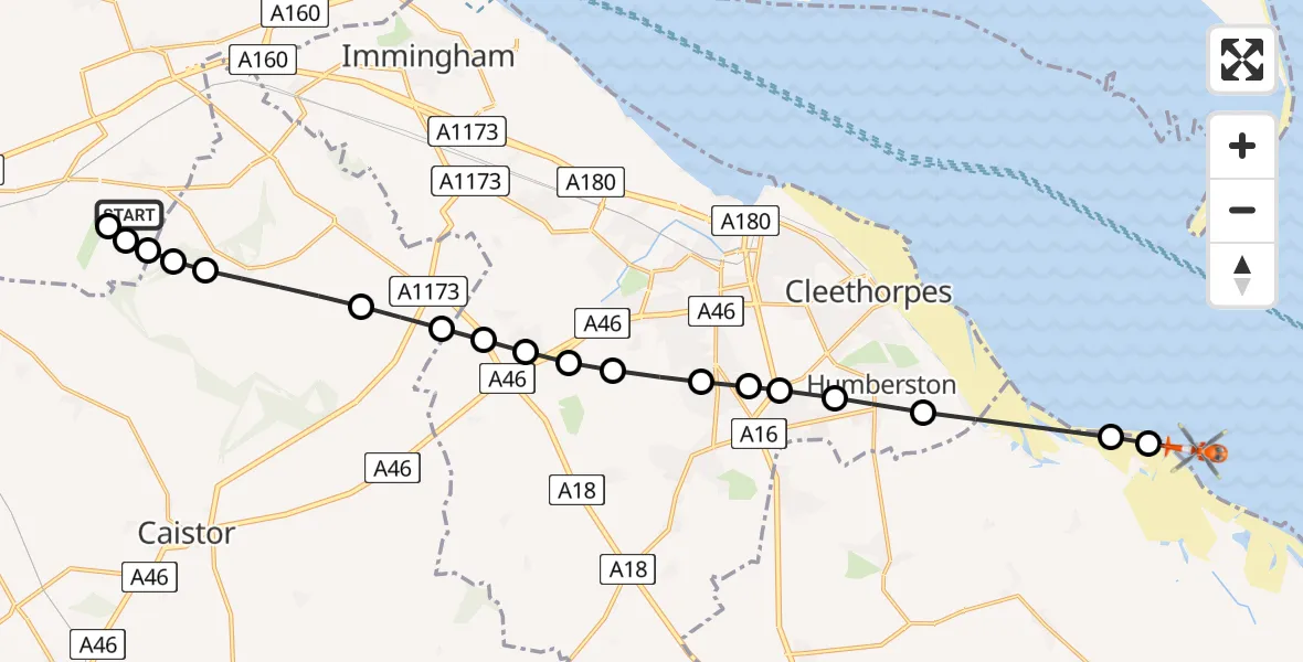
On Friday, 20 February 2026 at 22:11, a Coastguard Helicopter departed from Humberside Airport to North Sea. It was the Coastguard Helicopter with registration number G-MCGJ. The flight lasted 7 minutes. During that period, the aircraft travelled 20 miles at an average speed of 159 miles per hour at a maximum altitude of 2075 feet.
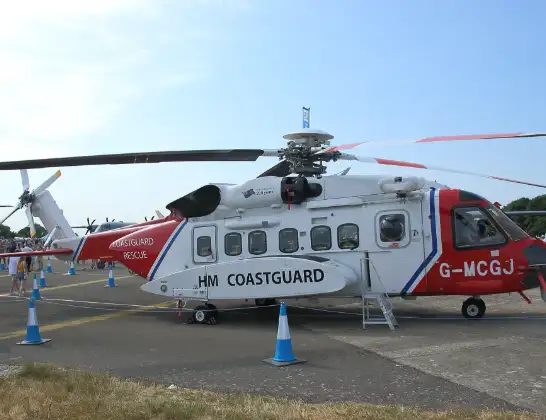
Helicopter: G-MCGJ
The helicopter G-MCGJ is used by the British Coastguard. The helicopter is deployed in search and rescue operations at sea, rescue operations involving ships or drilling platforms, patrols to prevent smuggling or piracy, environmental monitoring and disaster relief support.
Photo: simon butler
20 miles
2075 feet
159 mph
8 minutes
22:11
22:19

Route
North Sea, 22:19
North Sea22:19
East Lindsey, Greater Lincolnshire22:18
Humberston, Greater Lincolnshire22:17
Grimsby, Greater Lincolnshire22:17
New Waltham, Greater Lincolnshire22:17
Scartho, Greater Lincolnshire22:17
Grimsby, Greater Lincolnshire22:16
Bradley, Greater Lincolnshire22:16
Laceby, Greater Lincolnshire22:16
Grimsby, Greater Lincolnshire22:15
Aylesby, Greater Lincolnshire22:15
Grimsby, Greater Lincolnshire22:15
West Lindsey, Greater Lincolnshire22:14
Great Limber CP, West Lindsey22:13
West Lindsey, Greater Lincolnshire22:13
Kirmington, Greater Lincolnshire22:13
Great Limber CP, Greater Lincolnshire22:13
Kirmington, Greater Lincolnshire22:12
Humberside Airport, Grimsby, Lincolnshire22:11
Live flights
Today
Police Helicopter to Epping Forest, Green Lane26 Feb 23:43
Helicopter flights on your website?
You can easily display helicopter flights on your own website. Use the embed code.
