Police Helicopter to East Ardsley, Stoney Lane
Friday, 20 February 2026 | 12:30 | From East Ardsley
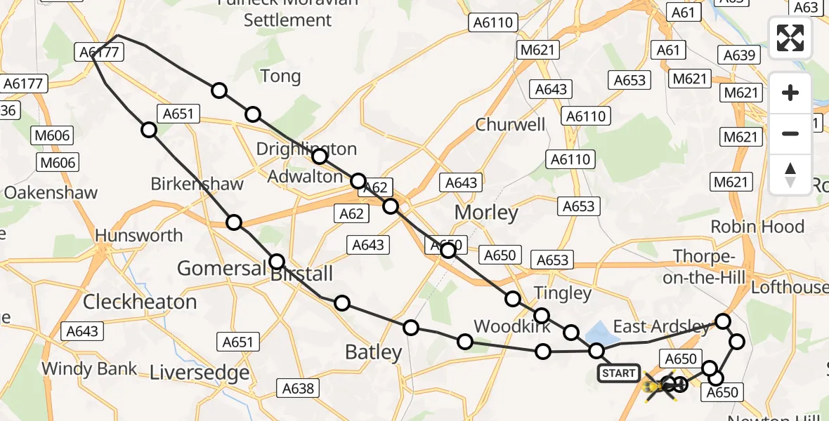
On Friday, 20 February 2026 at 12:30, a Police Helicopter departed from East Ardsley to East Ardsley. It was the Police Helicopter with registration number G-POLB. The flight lasted 10 minutes. During that period, the aircraft travelled 21 miles at an average speed of 120 miles per hour at a maximum altitude of 1900 feet.
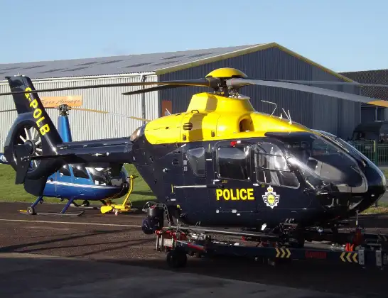
Helicopter: G-POLB
The helicopter G-POLB is used by the British police. The helicopter is deployed in pursuits, missing persons cases and other incidents where a helicopter provides added value.
Photo: James from Cheltenham, Gloucestershire
21 miles
1900 feet
120 mph
11 minutes
12:30
12:41

Route
Stoney Lane, Leeds12:41
East Ardsley, Leeds12:41
Wakefield, West Yorkshire12:40
Newton Hill, Wakefield12:40
Wrenthorpe, Wakefield12:40
Lofthouse Gate, Wakefield12:39
Wakefield, West Yorkshire12:39
East Ardsley, Leeds12:38
Tingley, Wakefield12:38
Batley, Kirklees12:38
Morley, Leeds12:37
Batley, Kirklees12:37
Birstall, Kirklees12:37
Gomersal, Kirklees12:36
Birkenshaw, Kirklees12:35
Bradford, West Yorkshire12:34
Tong, Bradford12:33
Drighlington, Leeds12:33
Adwalton, Leeds12:33
Gildersome, Leeds12:32
Morley, Leeds12:32
Woodkirk, Morley12:31
Tingley, Morley12:31
Tingley, Leeds12:31
Blind Lane, Leeds12:30
Live flights
Police Helicopter on its way from Wrenthorpe15 Jul 23:36
Today
Police Helicopter to MOD St Athan15 Jul 23:53
Helicopter flights on your website?
You can easily display helicopter flights on your own website. Use the embed code.
