Police Helicopter to East Ardsley, Stoney Lane
Thursday, 19 February 2026 | 16:10 | From Sherburn-in-Elmet Airfield
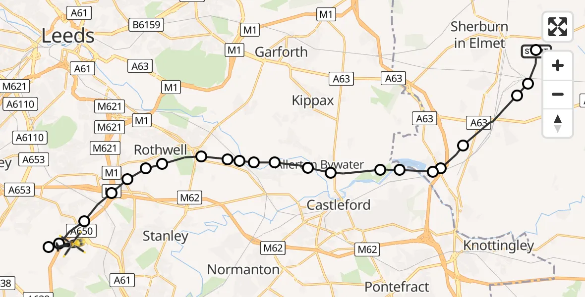
On Thursday, 19 February 2026 at 16:10, a Police Helicopter departed from Sherburn-in-Elmet Airfield to East Ardsley. It was the Police Helicopter with registration number G-POLB. The flight lasted 9 minutes. During that period, the aircraft travelled 18 miles at an average speed of 118 miles per hour at a maximum altitude of 900 feet.
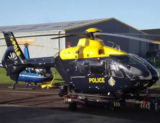
Helicopter: G-POLB
The helicopter G-POLB is used by the British police. The helicopter is deployed in pursuits, missing persons cases and other incidents where a helicopter provides added value.
Photo: James from Cheltenham, Gloucestershire
18 miles
900 feet
118 mph
9 minutes
16:10
16:19

Route
Stoney Lane, Leeds16:19
East Ardsley, Leeds16:19
Woodkirk, Leeds16:19
East Ardsley, Leeds16:18
Thorpe-on-the-Hill, Leeds16:18
Lofthouse, Leeds16:17
Carlton, Wakefield16:17
Rothwell, Leeds16:17
Oulton, Leeds16:16
Woodlesford, Leeds16:16
Methley, Leeds16:16
Swillington, Leeds16:16
Mickletown, Leeds16:15
Lower Mickletown, Leeds16:15
Allerton Bywater, Leeds16:15
Ledston, Leeds16:14
New Fryston, Wakefield16:14
Fairburn, York and North Yorkshire16:13
Brotherton, York and North Yorkshire16:13
Burton Salmon, York and North Yorkshire16:13
Monk Fryston, York and North Yorkshire16:12
South Milford, York and North Yorkshire16:11
Sherburn in Elmet, York and North Yorkshire16:10
Lennerton Lane, York and North Yorkshire16:10
Today
Helicopter flights on your website?
You can easily display helicopter flights on your own website. Use the embed code.
