Police Helicopter to MOD St Athan
Thursday, 19 February 2026 | 10:44 | From Swansea
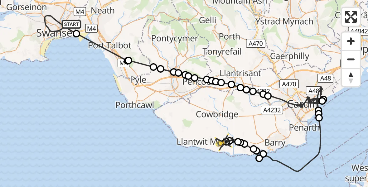
On Thursday, 19 February 2026 at 10:44, a Police Helicopter departed from Swansea to MOD St Athan. It was the Police Helicopter with registration number G-NWOI. The flight lasted 52 minutes. During that period, the aircraft travelled 94 miles at an average speed of 109 miles per hour at a maximum altitude of 1950 feet.

Helicopter: G-NWOI
The helicopter G-NWOI is used by the British police. The helicopter is deployed in pursuits, missing persons cases and other incidents where a helicopter provides added value.
Photo: James from Cheltenham
95 miles
1950 feet
109 mph
52 minutes
10:44
11:36

Route
MOD St Athan, St Athan, Vale of Glamorgan11:36
MOD St Athan, St Athan, Vale of Glamorgan11:36
Flemingston11:36
Llancarfan11:35
Barry11:35
Penmark11:35
Cardiff International Airport, Cardiff11:34
Rhoose11:34
Bristol Channel11:33
Rhoose11:33
Bristol Channel11:26
Cardiff11:26
Tremorfa11:26
Cardiff11:25
Rumney11:25
Cardiff11:00
St. Georges-super-Ely11:00
Peterston-super-Ely10:59
Pendoylan10:59
Miskin10:59
Brynsadler10:58
Llanharry10:58
Bryncae10:57
Brynna10:57
Llanilid10:57
Pencoed10:56
Heol-y-cyw10:56
Coity10:56
Bryncethin10:55
Sarn10:55
Tondu10:54
Llangynwyd Lower10:54
Coed Hirwaun10:53
Margam10:52
Jersey Marine10:49
Ty Draw Road, 10:44
Live flights
Today
Flights Swansea
Helicopter flights on your website?
You can easily display helicopter flights on your own website. Use the embed code.
