Coastguard Helicopter to Inner Seas, Inner Seas
Thursday, 19 February 2026 | 2:25 | From Inverness Airport
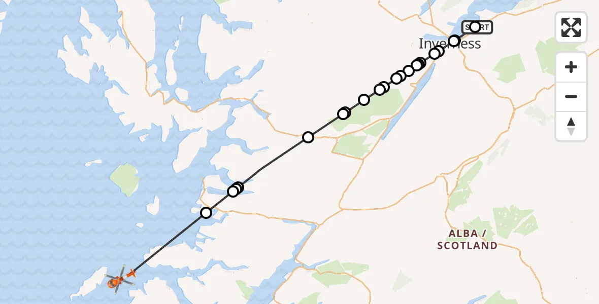
On Thursday, 19 February 2026 at 2:25, a Coastguard Helicopter departed from Inverness Airport to Inner Seas. It was the Coastguard Helicopter with registration number G-MCGT. The flight lasted 48 minutes. During that period, the aircraft travelled 107 miles at an average speed of 133 miles per hour at a maximum altitude of 6325 feet.
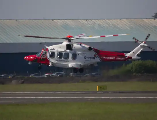
Helicopter: G-MCGT
The helicopter G-MCGT is used by the British Coastguard. The helicopter is deployed in search and rescue operations at sea, rescue operations involving ships or drilling platforms, patrols to prevent smuggling or piracy, environmental monitoring and disaster relief support.
Photo: Ronnie Macdonald
107 miles
6325 feet
133 mph
49 minutes
02:25
03:13

Route
Inner Seas, 03:13
Inner Seas03:02
Loch Morar02:58
Tarbet02:58
Kylesmorar02:58
Cluanie Estate helipad02:49
Imladris02:45
Cougie02:45
Tomich02:42
Corrimony02:41
Shenval02:40
Balnain02:39
Achtemarack02:38
Milton02:37
Abriachan02:36
Kirkhill and Bunchrew02:36
Inverness West02:36
Inverness02:34
Inverness West02:33
Inverness02:31
Crown and City Centre02:31
Inverness02:26
Inverness Airport, Inverness02:26
Inverness Airport, Inverness02:25
Live flights
Today
Helicopter flights on your website?
You can easily display helicopter flights on your own website. Use the embed code.
