Air Ambulance Helicopter to Watford, Watford Field Road
Wednesday, 18 February 2026 | 17:56 | From North Weald Airfield
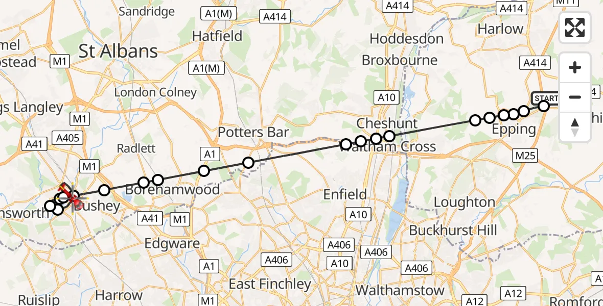
On Wednesday, 18 February 2026 at 17:56, a Air Ambulance Helicopter departed from North Weald Airfield to Watford. It was the Air Ambulance Helicopter with registration number G-EHAT. The flight lasted 16 minutes. During that period, the aircraft travelled 29 miles at an average speed of 106 miles per hour at a maximum altitude of 1700 feet.
Helicopter: G-EHAT
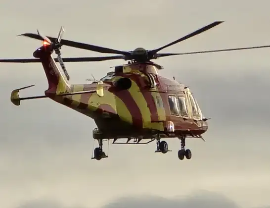
The helicopter G-EHAT is used as a air ambulance helicopter. The main purpose of this aircraft is to transport a Mobile Medical Team to an incident as quickly as possible, enabling the trauma doctor to provide immediate first aid on site. The aircraft is flying this flight as Air Ambulance Helicopter.
Photo: By Steve Knight
29 miles
1700 feet
106 mph
17 minutes
17:56
18:12

Route
Watford Field Road, 18:12
Watford18:11
Watford General Hospital, Watford18:11
Watford18:10
Three Rivers18:10
Watford18:07
Bushey, Hertsmere18:07
Aldenham, Hertsmere18:06
Elstree, Hertsmere18:06
Borehamwood, Hertsmere18:05
Potters Bar, Hertsmere18:04
London Borough of Enfield, Greater London18:02
Waltham Cross18:02
Churchgate, Broxbourne18:02
Waltham Cross18:02
Epping Forest, Essex18:00
Ivy Chimneys, Epping Forest18:00
Epping, Epping Forest18:00
Coopersale Street, Epping17:59
Coopersale, Epping17:59
North Weald Bassett, Epping Forest17:59
North Weald Airfield, Epping, Essex17:57
North Weald Airfield, Epping, Essex17:56
Live flights
Police Helicopter on its way from RAF Benson12 Jul 22:54
Police Helicopter on its way from Dundrod12 Jul 22:50
Police Helicopter on its way from East Ardsley12 Jul 22:44
Police Helicopter on its way from Worsley12 Jul 22:11
Today
Air Ambulance Helicopter to Glasgow Airport12 Jul 22:48
Air Ambulance Helicopter to Norwich Airport12 Jul 22:27
Air Ambulance Helicopter to Northrepps Aerodrome12 Jul 22:23
Police Helicopter to Harborough, Sulby Road12 Jul 22:20
Air Ambulance Helicopter to Derriford Hospital12 Jul 22:12
Air Ambulance Helicopter to Northrepps Aerodrome12 Jul 22:03
Flights Watford
Air Ambulance Helicopter to Watford, Ebury Way13 Jun 15:46
Air Ambulance Helicopter to Elstree Airfield3 Apr 12:31
Air Ambulance Helicopter to North Weald Airfield23 Feb 15:41
Air Ambulance Helicopter to Watford, Coates Way23 Feb 11:48
Helicopter flights on your website?
You can easily display helicopter flights on your own website. Use the embed code.
