Air Ambulance Helicopter to Old Tupton, Derby Road
Wednesday, 18 February 2026 | 12:52 | From Danesmoor
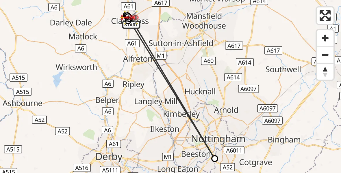
On Wednesday, 18 February 2026 at 12:52, a Air Ambulance Helicopter departed from Danesmoor to Old Tupton. It was the Air Ambulance Helicopter with registration number G-DRLA. The flight lasted 5 minutes. During that period, the aircraft travelled 44 miles at an average speed of 551 miles per hour at a maximum altitude of 1500 feet.
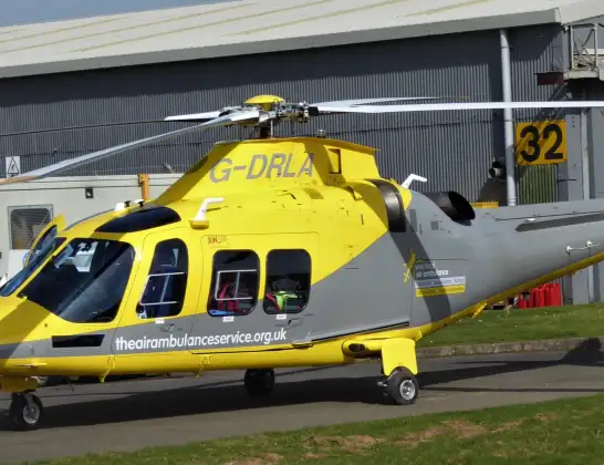
Helicopter: G-DRLA
The helicopter G-DRLA is used as an ambulance helicopter. The helicopter is equipped with a stretcher for transporting patients. The helicopter is often used to transport to hospitals.
Photo: Alec Wilson
45 miles
1500 feet
551 mph
5 minutes
12:52
12:57

Route
Derby Road, Clay Cross CP12:57
Old Tupton, Clay Cross CP12:56
Henmoor, Clay Cross CP12:55
City of Nottingham, East Midlands12:55
Old Tupton, Clay Cross CP12:54
Henmoor, Clay Cross CP12:54
Old Tupton, Clay Cross CP12:54
Henmoor, Clay Cross CP12:53
Old Tupton, Clay Cross CP12:52
Henmoor, Clay Cross CP12:52
Springvale Road, Clay Cross CP12:52
Live flights
Today
Flights Danesmoor
Helicopter flights on your website?
You can easily display helicopter flights on your own website. Use the embed code.
