Air Ambulance Helicopter to Pinxton, Wharf Road
Wednesday, 18 February 2026 | 12:43 | From Nottingham Heliport
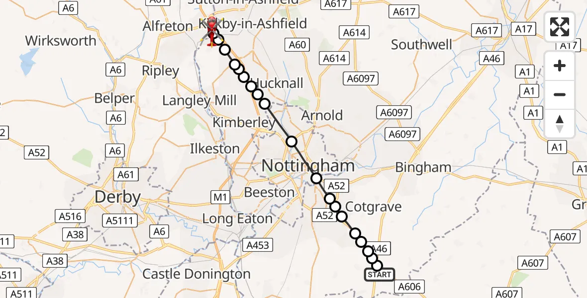
On Wednesday, 18 February 2026 at 12:43, a Air Ambulance Helicopter departed from Nottingham Heliport to Pinxton. It was the Air Ambulance Helicopter with registration number G-DRLA. The flight lasted 7 minutes. During that period, the aircraft travelled 22 miles at an average speed of 186 miles per hour at a maximum altitude of 1700 feet.
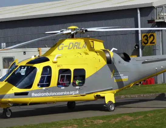
Helicopter: G-DRLA
The helicopter G-DRLA is used as an ambulance helicopter. The helicopter is equipped with a stretcher for transporting patients. The helicopter is often used to transport to hospitals.
Photo: Alec Wilson
23 miles
1700 feet
186 mph
8 minutes
12:43
12:50

Route
Wharf Road, Bolsover12:50
Pinxton, Bolsover12:50
Selston CP, Ashfield12:50
Selston CP, City of Nottingham12:49
Selston CP, Ashfield12:49
Ashfield, East Midlands12:49
Watnall, Ashfield12:49
Greasley, Broxtowe12:48
Hucknall, Ashfield12:48
Hucknall Airfield, Nottingham12:48
Bulwell, City of Nottingham12:47
City of Nottingham, East Midlands12:46
West Bridgford, Rushcliffe12:45
Tollerton, West Bridgford12:45
Tollerton, Rushcliffe12:45
Normanton on the Wolds, Rushcliffe12:44
Stanton on the Wolds, Rushcliffe12:44
Stanton on the Wolds, City of Nottingham12:44
Widmerpool, Rushcliffe12:44
Hickling, Rushcliffe12:43
Nottingham Heliport, 12:43
Live flights
Today
Flights Pinxton
Air Ambulance Helicopter to Pinxton, Wharf Road18 Feb 12:43
Helicopter flights on your website?
You can easily display helicopter flights on your own website. Use the embed code.
