Air Ambulance Helicopter to YAA Nostell Helicopter Port
Tuesday, 17 February 2026 | 16:07 | From Allerton Bywater
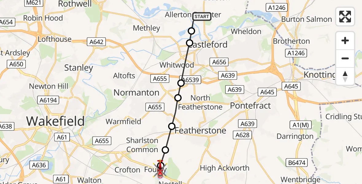
On Tuesday, 17 February 2026 at 16:07, a Air Ambulance Helicopter departed from Allerton Bywater to YAA Nostell Helicopter Port. It was the Air Ambulance Helicopter with registration number G-YAAA. The flight lasted 4 minutes. During that period, the aircraft travelled 6 miles at an average speed of 93 miles per hour at a maximum altitude of 1025 feet.
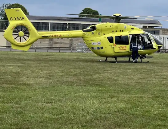
Helicopter: G-YAAA
The helicopter G-YAAA is used as a air ambulance helicopter. The main purpose of this aircraft is to transport a Mobile Medical Team to an incident as quickly as possible, enabling the trauma doctor to provide immediate first aid on site. The aircraft is flying this flight as Air Ambulance Helicopter.
Photo: Jennifer Petrie
7 miles
1025 feet
93 mph
5 minutes
16:07
16:11

Route
YAA Nostell Helicopter Port, Foulby, Nostell, Yorkshire16:11
YAA Nostell Helicopter Port, Foulby, Nostell, Yorkshire16:11
Nostell, Wakefield16:10
Streethouse, Featherstone16:10
Ackton, Featherstone16:09
Whitwood, Featherstone16:09
Whitwood, Wakefield16:08
Castleford, Wakefield16:08
Station Road, Leeds16:07
Live flights
Police Helicopter on its way from Woodkirk16 Jul 22:20
Today
Air Ambulance Helicopter to Treliske Hospital16 Jul 22:54
Police Helicopter to Hawarden Airport16 Jul 22:41
Air Ambulance Helicopter to Redhill Aerodrome16 Jul 22:14
Police Helicopter to Sewardstonebury, Bury Road16 Jul 22:11
Coastguard Helicopter to English Channel16 Jul 22:09
Helicopter flights on your website?
You can easily display helicopter flights on your own website. Use the embed code.
