Air Ambulance Helicopter to YAA Nostell Helicopter Port
Tuesday, 17 February 2026 | 13:26 | From Horbury Bridge
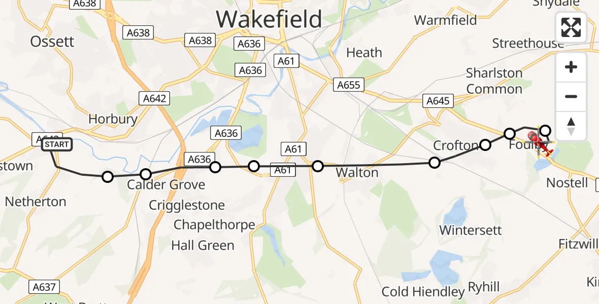
On Tuesday, 17 February 2026 at 13:26, a Air Ambulance Helicopter departed from Horbury Bridge to YAA Nostell Helicopter Port. It was the Air Ambulance Helicopter with registration number G-YORX. The flight lasted 6 minutes. During that period, the aircraft travelled 8 miles at an average speed of 82 miles per hour at a maximum altitude of 1050 feet.
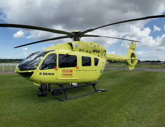
Helicopter: G-YORX
The helicopter G-YORX is used as a air ambulance helicopter. The main purpose of this aircraft is to transport a Mobile Medical Team to an incident as quickly as possible, enabling the trauma doctor to provide immediate first aid on site. The aircraft is flying this flight as Air Ambulance Helicopter.
Photo: Arollin96227
9 miles
1050 feet
82 mph
7 minutes
13:26
13:32

Route
YAA Nostell Helicopter Port, Foulby, Nostell, Yorkshire13:32
YAA Nostell Helicopter Port, Foulby, Nostell, Yorkshire13:32
YAA Nostell Helicopter Port, Foulby, Nostell, Yorkshire13:31
Sharlston, Wakefield13:31
New Crofton, Wakefield13:31
Crofton, Wakefield13:30
Walton, Wakefield13:29
Kettlethorpe, Wakefield13:29
Durkar, Wakefield13:29
Calder Grove, Wakefield13:28
Horbury, Wakefield13:28
Netherton Lane, Wakefield13:26
Horbury Bridge, Wakefield13:26
Live flights
Police Helicopter on its way from MOD St Athan16 Jul 23:47
Police Helicopter on its way from Hortham16 Jul 23:31
Today
Air Ambulance Helicopter to Henstridge Airfield16 Jul 23:35
Air Ambulance Helicopter to Treliske Hospital16 Jul 22:54
Coastguard Helicopter to Solent Airport16 Jul 22:47
Police Helicopter to Hawarden Airport16 Jul 22:41
Helicopter flights on your website?
You can easily display helicopter flights on your own website. Use the embed code.
