Coastguard Helicopter to Praa Sands, Castle Drive
Tuesday, 17 February 2026 | 13:09 | From Cornwall Airport Newquay
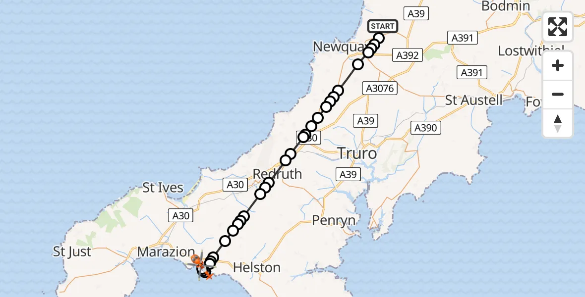
On Tuesday, 17 February 2026 at 13:09, a Coastguard Helicopter departed from Cornwall Airport Newquay to Praa Sands. It was the Coastguard Helicopter with registration number G-MCGF. The flight lasted 14 minutes. During that period, the aircraft travelled 31 miles at an average speed of 131 miles per hour at a maximum altitude of 975 feet.
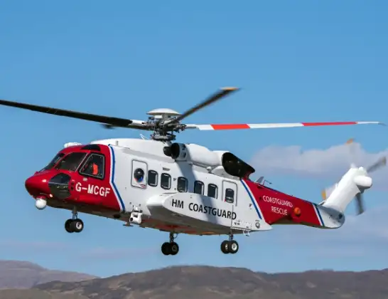
Helicopter: G-MCGF
The helicopter G-MCGF is used by the British Coastguard. The helicopter is deployed in search and rescue operations at sea, rescue operations involving ships or drilling platforms, patrols to prevent smuggling or piracy, environmental monitoring and disaster relief support.
Photo: The Carlisle Kid
31 miles
975 feet
131 mph
15 minutes
13:09
13:23

Route
Castle Drive, 13:23
Praa Sands13:21
Germoe13:21
Ashton13:21
Praa Sands13:20
Breage13:20
Germoe13:20
Godolphin Cross13:19
Nancegollan13:19
Praze-An-Beeble13:18
Nancegollan13:18
Praze-An-Beeble13:18
Troon, Camborne13:17
Four Lanes13:17
Illogan Highway13:16
Redruth13:15
Scorrier13:15
Blackwater13:14
St. Agnes13:14
Perrancoombe13:14
Perranzabuloe13:13
Bolingey13:13
Goonhavern13:13
Goonhavern, Truro13:12
Perranzabuloe13:12
St. Newlyn East13:11
Kestle Mill13:10
Colan13:10
St. Columb Minor13:10
St. Columb Major13:10
Cornwall Airport Newquay, Newquay13:09
Live flights
Air Ambulance Helicopter on its way from Ashford14 Jul 23:46
Coastguard Helicopter on its way from North Sea14 Jul 23:44
Today
Police Helicopter to Johnstone, Gordon Square14 Jul 23:38
Coastguard Helicopter to North Sea14 Jul 23:30
Police Helicopter to Inner Seas14 Jul 23:12
Air Ambulance Helicopter to Norwich Airport14 Jul 22:52
Police Helicopter to Manchester Barton Aerodrome14 Jul 22:50
Police Helicopter to Sewardstonebury, Bury Road14 Jul 22:44
Air Ambulance Helicopter to Cardiff Heliport14 Jul 22:43
Helicopter flights on your website?
You can easily display helicopter flights on your own website. Use the embed code.
