Air Ambulance Helicopter to Swanley, Nightingale Way
Tuesday, 17 February 2026 | 5:23 | From Redhill Aerodrome
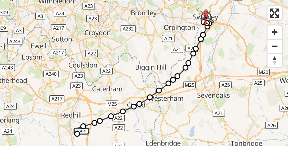
On Tuesday, 17 February 2026 at 5:23, a Air Ambulance Helicopter departed from Redhill Aerodrome to Swanley. It was the Air Ambulance Helicopter with registration number G-LNAC. The flight lasted 16 minutes. During that period, the aircraft travelled 26 miles at an average speed of 101 miles per hour at a maximum altitude of 1700 feet.
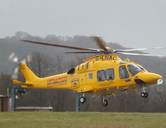
Helicopter: G-LNAC
The helicopter G-LNAC is used as a air ambulance helicopter. The main purpose of this aircraft is to transport a Mobile Medical Team to an incident as quickly as possible, enabling the trauma doctor to provide immediate first aid on site. The aircraft is flying this flight as Air Ambulance Helicopter.
Photo: James from Cheltenham, Gloucestershire
27 miles
1700 feet
101 mph
16 minutes
05:23
05:39

Route
Swanley05:39
Nightingale Way, 05:39
Swanley05:36
Crockenhill, Sevenoaks05:35
Swanley05:33
Crockenhill, Sevenoaks05:33
Well Hill, Sevenoaks05:32
Great Cockerhurst, Sevenoaks05:32
Shoreham, Sevenoaks05:32
Badger's Mount, Sevenoaks05:31
Halstead, Sevenoaks05:31
Knockholt Pound, Sevenoaks05:31
Knockholt, Sevenoaks05:30
Brasted, Sevenoaks05:30
London Borough of Bromley, Greater London05:30
Westerham05:29
Tandridge05:29
Limpsfield05:28
Old Oxted, Oxted05:28
Old Oxted05:27
Godstone05:27
Bletchingley05:26
Nutfield05:26
South Nutfield05:26
Salfords, Reigate and Banstead05:25
Redhill Aerodrome, Redhill, Surrey05:23
Live flights
Today
Flights Swanley
Air Ambulance Helicopter to Swanley, Wested Lane17 Apr 10:06
Air Ambulance Helicopter to Swanley, Wested Lane17 Apr 09:47
Air Ambulance Helicopter to Swanley, London Road19 Mar 20:24
Air Ambulance Helicopter to Redhill Aerodrome17 Feb 06:30
Air Ambulance Helicopter to Swanley17 Feb 05:41
Air Ambulance Helicopter to Swanley17 Feb 05:41
Helicopter flights on your website?
You can easily display helicopter flights on your own website. Use the embed code.
