Police Helicopter to MOD St Athan, MOD St Athan
Monday, 16 February 2026 | 20:11 | From MOD St Athan
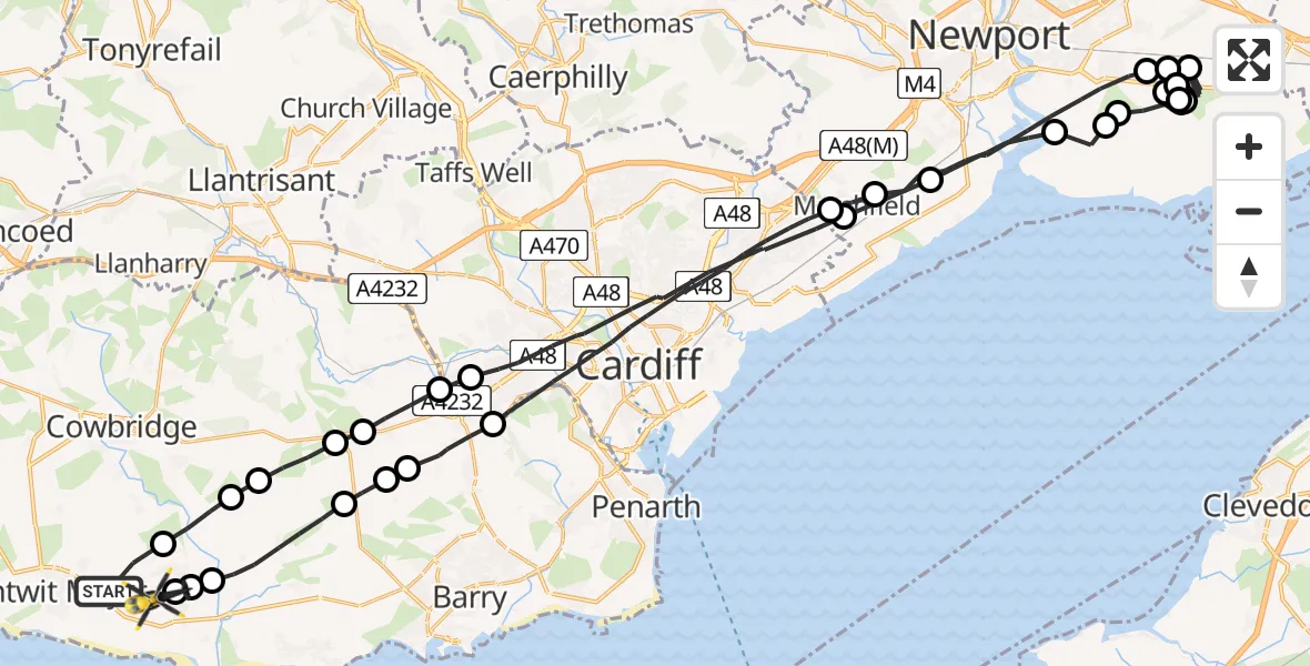
On Monday, 16 February 2026 at 20:11, a Police Helicopter departed from MOD St Athan to MOD St Athan. It was the Police Helicopter with registration number G-NWOI. The flight lasted 54 minutes. During that period, the aircraft travelled 69 miles at an average speed of 78 miles per hour at a maximum altitude of 1800 feet.

Helicopter: G-NWOI
The helicopter G-NWOI is used by the British police. The helicopter is deployed in pursuits, missing persons cases and other incidents where a helicopter provides added value.
Photo: James from Cheltenham
70 miles
1800 feet
78 mph
54 minutes
20:11
21:05

Route
MOD St Athan, St Athan, Vale of Glamorgan21:05
MOD St Athan, St Athan, Vale of Glamorgan21:05
Flemingston21:05
St Athan21:04
Llancarfan21:03
Dyffryn21:02
St Nicholas21:02
Wenvoe21:01
Cardiff20:57
Marshfield20:56
Newport20:54
Nash20:54
Newport20:54
Whitson20:53
Newport20:48
Llanwern20:47
Newport20:47
Whitson20:45
Newport20:42
Whitson20:32
Newport20:32
Whitson20:31
Newport20:31
Whitson20:30
Newport20:30
Whitson20:28
Newport20:27
Whitson20:27
Newport20:27
Whitson20:26
Newport20:23
Whitson20:23
Newport20:22
Llanwern20:22
Newport20:19
Marshfield20:19
Cardiff20:15
Drope20:15
St Nicholas20:14
Bonvilston20:14
Llancarfan20:13
Bonvilston20:13
Flemingston20:12
MOD St Athan, St Athan, Vale of Glamorgan20:11
Live flights
Today
Helicopter flights on your website?
You can easily display helicopter flights on your own website. Use the embed code.
