Coastguard Helicopter to Hope, Ruin Edge Lane
Monday, 16 February 2026 | 18:03 | From High Peak
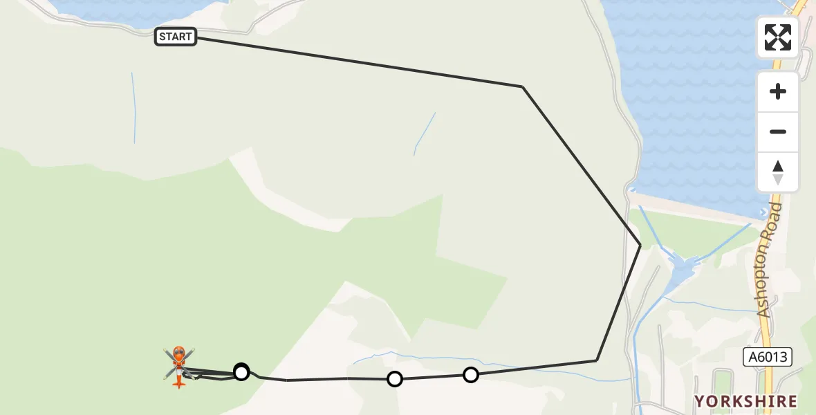
On Monday, 16 February 2026 at 18:03, a Coastguard Helicopter departed from High Peak to Hope. It was the Coastguard Helicopter with registration number G-MCGE. The flight lasted 7 minutes. During that period, the aircraft travelled 2 miles at an average speed of 18 miles per hour at a maximum altitude of 2100 feet.
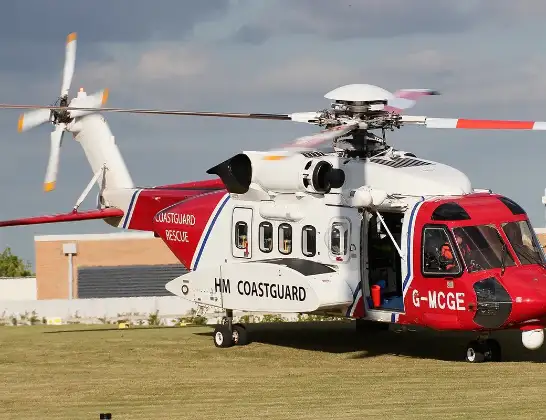
Helicopter: G-MCGE
The helicopter G-MCGE is used by the British Coastguard. The helicopter is deployed in search and rescue operations at sea, rescue operations involving ships or drilling platforms, patrols to prevent smuggling or piracy, environmental monitoring and disaster relief support.
Photo: Mike Burdett
3 miles
2100 feet
18 mph
8 minutes
18:03
18:10

Route
Ruin Edge Lane, High Peak18:10
Hope, High Peak18:07
High Peak, East Midlands18:07
Hope, High Peak18:06
High Peak, East Midlands18:04
Thornhill, High Peak18:04
Snake Road, East Midlands18:03
Today
Police Helicopter to Epping Forest, Green Lane26 Feb 23:43
Flights Hope
Coastguard Helicopter to High Peak, Snake Path17 Feb 17:59
Coastguard Helicopter to Hope, Edale Road17 Feb 17:11
Coastguard Helicopter to Hope, Ruin Edge Lane16 Feb 18:03
Coastguard Helicopter to Hope, Edale Road16 Feb 16:59
Coastguard Helicopter to Hope, Edale Road20 Jan 10:54
Coastguard Helicopter to Hope, Edale Road20 Jan 10:04
Helicopter flights on your website?
You can easily display helicopter flights on your own website. Use the embed code.
