Police Helicopter to Brent Knoll, Vole Road
Monday, 16 February 2026 | 0:46 | From MOD St Athan
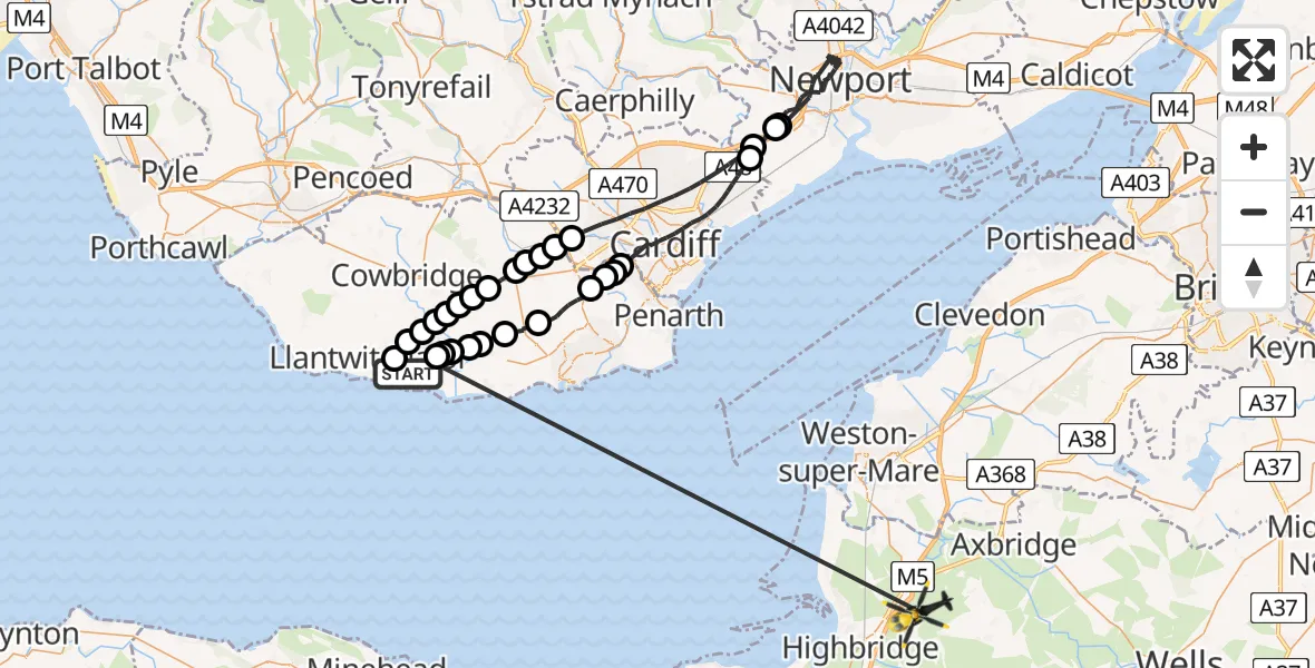
On Monday, 16 February 2026 at 0:46, a Police Helicopter departed from MOD St Athan to Brent Knoll. It was the Police Helicopter with registration number G-NWOI. The flight lasted 26 minutes. During that period, the aircraft travelled 77 miles at an average speed of 176 miles per hour at a maximum altitude of 1925 feet.

Helicopter: G-NWOI
The helicopter G-NWOI is used by the British police. The helicopter is deployed in pursuits, missing persons cases and other incidents where a helicopter provides added value.
Photo: Alec Wilson
78 miles
1925 feet
176 mph
27 minutes
00:46
01:13

Route
Vole Road, 01:13
MOD St Athan, St Athan, Vale of Glamorgan01:12
Flemingston01:12
St Athan01:12
Llancarfan01:11
Penmark01:11
Llancarfan01:10
Dyffryn01:09
Wenvoe01:07
Michaelston-le-Pit and Leckwith01:07
Michaelston-le-Pit01:07
Michaelston-le-Pit and Leckwith01:06
Cardiff01:02
Castleton01:01
Newport00:54
Castleton00:54
Cardiff00:50
Drope00:50
St Nicholas00:50
Peterston-super-Ely00:50
St Nicholas00:49
Bonvilston00:49
Llancarfan00:49
Bonvilston00:48
Llancarfan00:48
Flemingston00:48
St Mary Church00:48
Eglwys Brewis00:47
Boverton00:47
MOD St Athan, St Athan, Vale of Glamorgan00:46
Live flights
Police Helicopter on its way from Ewelme13 Jul 22:24
Today
Police Helicopter to Bournemouth Airport13 Jul 23:55
Air Ambulance Helicopter to Cardiff Heliport13 Jul 23:38
Police Helicopter to Birmingham Airport13 Jul 23:21
Police Helicopter to Irlam, Twelve Yards Road13 Jul 23:00
Helicopter flights on your website?
You can easily display helicopter flights on your own website. Use the embed code.
