Police Helicopter to East Ardsley, Stoney Lane
Sunday, 15 February 2026 | 12:01 | From Wakefield
On Sunday, 15 February 2026 at 12:01, a Police Helicopter departed from Wakefield to East Ardsley. It was the Police Helicopter with registration number G-POLB. The flight lasted 36 minutes. During that period, the aircraft travelled 45 miles at an average speed of 76 miles per hour at a maximum altitude of 2000 feet.
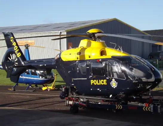
Helicopter: G-POLB
The helicopter G-POLB is used by the British police. The helicopter is deployed in pursuits, missing persons cases and other incidents where a helicopter provides added value.
Photo: James from Cheltenham, Gloucestershire
46 miles
2000 feet
76 mph
37 minutes
12:01
12:37

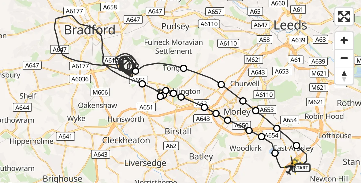
Route
Stoney Lane, Leeds12:37
East Ardsley, Leeds12:36
Tingley, Leeds12:36
Woodkirk, Morley12:35
Morley, Leeds12:35
Churwell, Morley12:35
Gildersome, Leeds12:34
Adwalton, Leeds12:34
Drighlington, Leeds12:34
Adwalton, Leeds12:33
Birkenshaw, Kirklees12:33
Adwalton, Leeds12:32
Birkenshaw, Kirklees12:32
Bradford, West Yorkshire12:05
Tong, Bradford12:04
Gildersome, Leeds12:04
Churwell, Morley12:03
Morley, Leeds12:03
Tingley, Leeds12:02
East Ardsley, Leeds12:02
Stoney Lane (path), West Yorkshire12:01
Today
Police Helicopter to Falkirk02:12:08
Flights Wakefield
Police Helicopter to Wakefield, Stephenson Way28 Mar 00:23
Police Helicopter to Wakefield, Bradford Road24 Mar 05:03
Police Helicopter to Wakefield, Lawns Lane24 Mar 05:03
Police Helicopter to Wakefield, Lawns Lane24 Mar 05:03
Police Helicopter to Wakefield, Lawns Lane24 Mar 05:03
Police Helicopter to Wakefield, Lawns Lane24 Mar 05:03
Police Helicopter to Wakefield, Lawns Lane24 Mar 05:03
Police Helicopter to Wakefield, Lawns Lane24 Mar 05:03
Helicopter flights on your website?
You can easily display helicopter flights on your own website. Use the embed code.
