Police Helicopter to East Ardsley, Stoney Lane
Saturday, 14 February 2026 | 23:28 | From East Ardsley
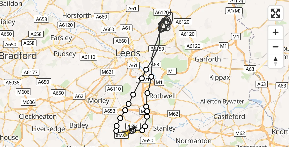
On Saturday, 14 February 2026 at 23:28, a Police Helicopter departed from East Ardsley to East Ardsley. It was the Police Helicopter with registration number G-POLB. The flight lasted 26 minutes. During that period, the aircraft travelled 37 miles at an average speed of 89 miles per hour at a maximum altitude of 1900 feet.
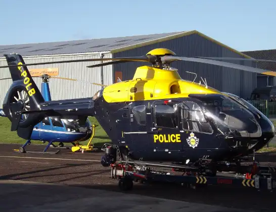
Helicopter: G-POLB
The helicopter G-POLB is used by the British police. The helicopter is deployed in pursuits, missing persons cases and other incidents where a helicopter provides added value.
Photo: James from Cheltenham, Gloucestershire
38 miles
1900 feet
89 mph
26 minutes
23:28
23:54

Route
Stoney Lane, Leeds23:54
East Ardsley, Leeds23:54
Wakefield, West Yorkshire23:53
Wrenthorpe, Wakefield23:53
Newton Hill, Wakefield23:52
Lofthouse Gate, Wakefield23:52
Lofthouse, Wakefield23:51
Robin Hood, Wakefield23:51
Robin Hood, Leeds23:51
Rothwell, Leeds23:50
Leeds, West Yorkshire23:31
Rothwell, Leeds23:30
Leeds, West Yorkshire23:30
Thorpe-on-the-Hill, Leeds23:30
Tingley, Leeds23:29
East Ardsley, Leeds23:29
Tingley, Leeds23:29
Woodkirk, Leeds23:29
Woodhouse Lane, Leeds23:28
Live flights
Today
Police Helicopter to MOD St Athan15 Jul 23:53
Police Helicopter to East Ardsley, Stoney Lane15 Jul 23:36
Helicopter flights on your website?
You can easily display helicopter flights on your own website. Use the embed code.
