Police Helicopter to Ewelme, The Sands
Saturday, 14 February 2026 | 16:44 | From Ewelme
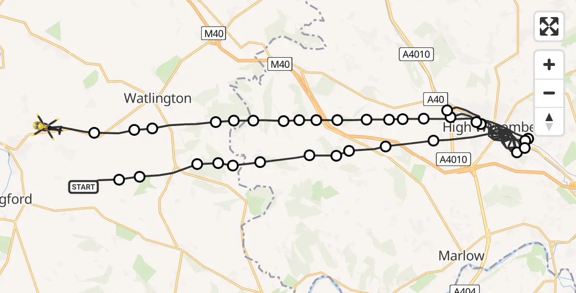
On Saturday, 14 February 2026 at 16:44, a Police Helicopter departed from Ewelme to Ewelme. It was the Police Helicopter with registration number G-POLF. The flight lasted 33 minutes. During that period, the aircraft travelled 48 miles at an average speed of 88 miles per hour at a maximum altitude of 1200 feet.
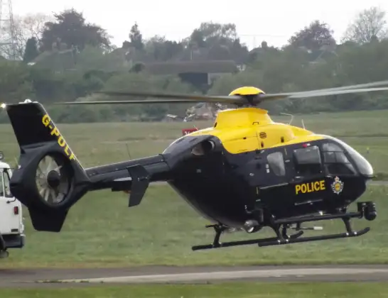
Helicopter: G-POLF
The helicopter G-POLF is used by the British police. The helicopter is deployed in pursuits, missing persons cases and other incidents where a helicopter provides added value.
Photo: James
48 miles
1200 feet
88 mph
33 minutes
16:44
17:17

Route
The Sands, South Oxfordshire17:17
Ewelme, South Oxfordshire17:16
Cookley Green, South Oxfordshire17:16
South Oxfordshire17:15
Watlington, South Oxfordshire17:14
Turville, Watlington17:14
Stokenchurch17:14
Ibstone17:13
Lane End17:13
Cadmore End17:13
Studley Green17:13
Cadmore End17:12
West Wycombe17:12
Piddington and Wheeler End17:12
West Wycombe17:11
High Wycombe17:00
High Wycombe Community Board16:59
High Wycombe16:58
High Wycombe Community Board16:58
High Wycombe16:55
West Wycombe16:55
High Wycombe16:54
Wycombe General Hospital, High Wycombe16:54
High Wycombe16:49
Lane End16:48
Cadmore End16:48
Fingest16:48
Ibstone16:47
Turville16:47
South Oxfordshire16:46
Watlington, South Oxfordshire16:46
Cookley Green, Watlington16:46
Cookley Green, South Oxfordshire16:45
South Oxfordshire16:45
Potters Lane, South Oxfordshire16:44
Live flights
Today
Flights Ewelme
Police Helicopter to RAF Benson12 Jul 13:27
Police Helicopter to Berrick Salome, Benson10 Jul 18:22
Police Helicopter to Berrick Salome, Benson10 Jul 17:26
Police Helicopter to Ewelme5 Jul 20:13
Helicopter flights on your website?
You can easily display helicopter flights on your own website. Use the embed code.
