Police Helicopter to Sewardstonebury, Daws Hill
Saturday, 14 February 2026 | 14:28 | From London Biggin Hill Airport
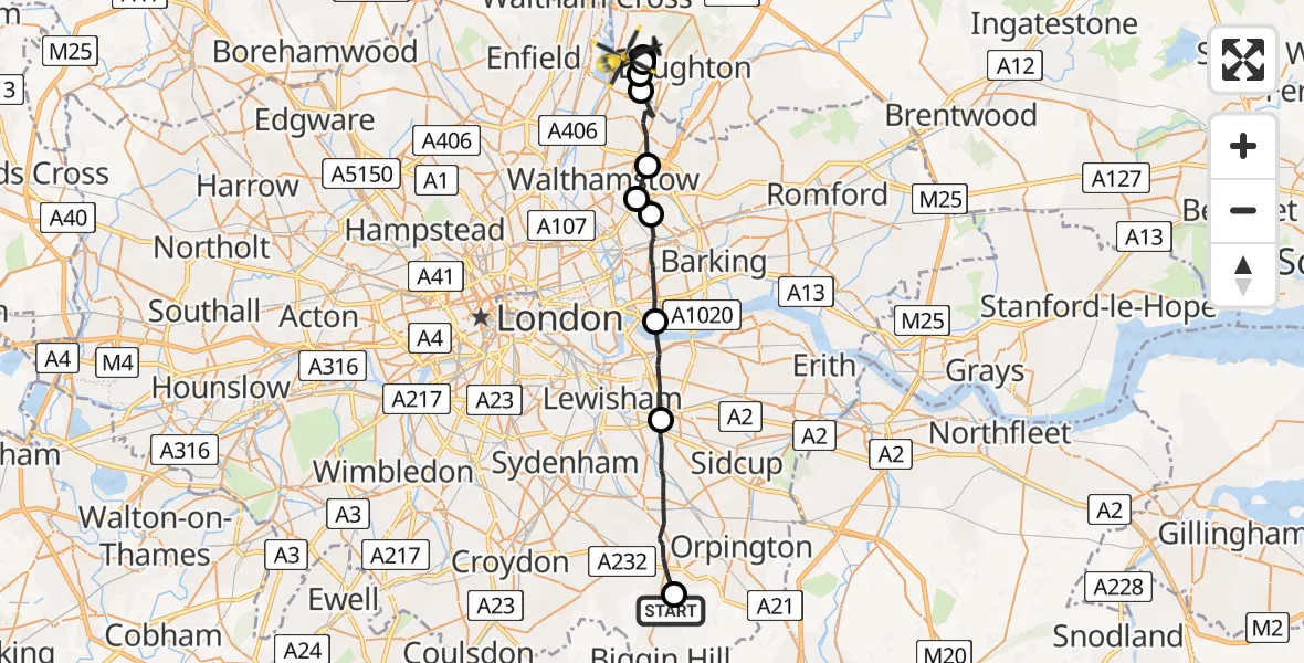
On Saturday, 14 February 2026 at 14:28, a Police Helicopter departed from London Biggin Hill Airport to Sewardstonebury. It was the Police Helicopter with registration number G-MPSA. The flight lasted 11 minutes. During that period, the aircraft travelled 24 miles at an average speed of 135 miles per hour at a maximum altitude of 1200 feet.
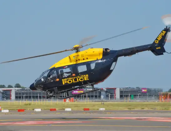
Helicopter: G-MPSA
The helicopter G-MPSA is used by the British police. The helicopter is deployed in pursuits, missing persons cases and other incidents where a helicopter provides added value.
Photo: Simon Boddy
25 miles
1200 feet
135 mph
11 minutes
14:28
14:39

Route
Daws Hill, Epping Forest14:39
Sewardstonebury, Epping Forest14:38
Metropolitan Police Air Support Unit Lippitts Hill, Loughton, Essex14:38
Sewardstonebury, Epping Forest14:38
London Borough of Waltham Forest, Greater London14:37
London Borough of Redbridge, Greater London14:36
London Borough of Waltham Forest, Greater London14:36
London Borough of Redbridge, Greater London14:35
London Borough of Newham, Greater London14:33
Royal Borough of Greenwich, Greater London14:31
London Borough of Bromley, Greater London14:28
New Road Hill, Greater London14:28
Live flights
Today
Flights Sewardstonebury
Police Helicopter to Sewardstonebury, Bury Road12 Jul 15:15
Police Helicopter to Sewardstonebury, Bury Road12 Jul 13:50
Police Helicopter to Sewardstonebury, Bury Road11 Jul 17:40
Police Helicopter to London Biggin Hill Airport11 Jul 13:12
Helicopter flights on your website?
You can easily display helicopter flights on your own website. Use the embed code.
