Air Ambulance Helicopter to Southampton, Wilton Road
Saturday, 14 February 2026 | 12:55 | From West Liss
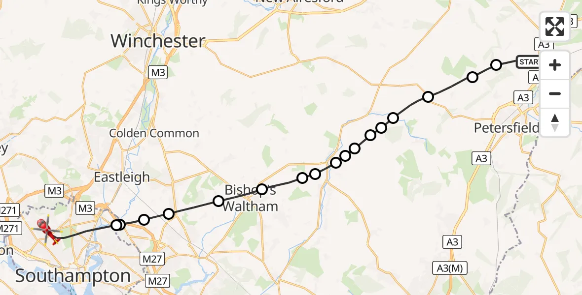
On Saturday, 14 February 2026 at 12:55, a Air Ambulance Helicopter departed from West Liss to Southampton. It was the Air Ambulance Helicopter with registration number G-HIOW. The flight lasted 12 minutes. During that period, the aircraft travelled 25 miles at an average speed of 129 miles per hour at a maximum altitude of 1400 feet.
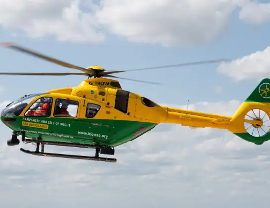
Helicopter: G-HIOW
The helicopter G-HIOW is used as a air ambulance helicopter. The main purpose of this aircraft is to transport a Mobile Medical Team to an incident as quickly as possible, enabling the trauma doctor to provide immediate first aid on site. The aircraft is flying this flight as Air Ambulance Helicopter.
Photo: JF2608
25 miles
1400 feet
129 mph
12 minutes
12:55
13:06

Route
Southampton13:06
Wilton Road, 13:06
Southampton13:04
West End, Southampton13:04
West End, Eastleigh13:04
Horton Heath, Eastleigh13:03
Durley, Winchester13:02
Bishop's Waltham, Winchester13:02
Droxford, Winchester13:01
Meonstoke Airstrip13:00
Meonstoke, Winchester13:00
Exton, Winchester13:00
Winchester13:00
West Meon, Winchester12:59
Winchester12:59
East Meon, East Hampshire12:59
East Hampshire12:58
High Cross, East Hampshire12:57
Honeycritch Lane, East Hampshire12:56
West Liss, East Hampshire12:55
Live flights
Today
Coastguard Helicopter to Corrie15:48:56
Flights Southampton
Coastguard Helicopter to Solent Airport6 Apr 13:12
Helicopter flights on your website?
You can easily display helicopter flights on your own website. Use the embed code.
