Police Helicopter to Burnhouse, Lochlibo Road
Friday, 13 February 2026 | 18:00 | From Bo'ness
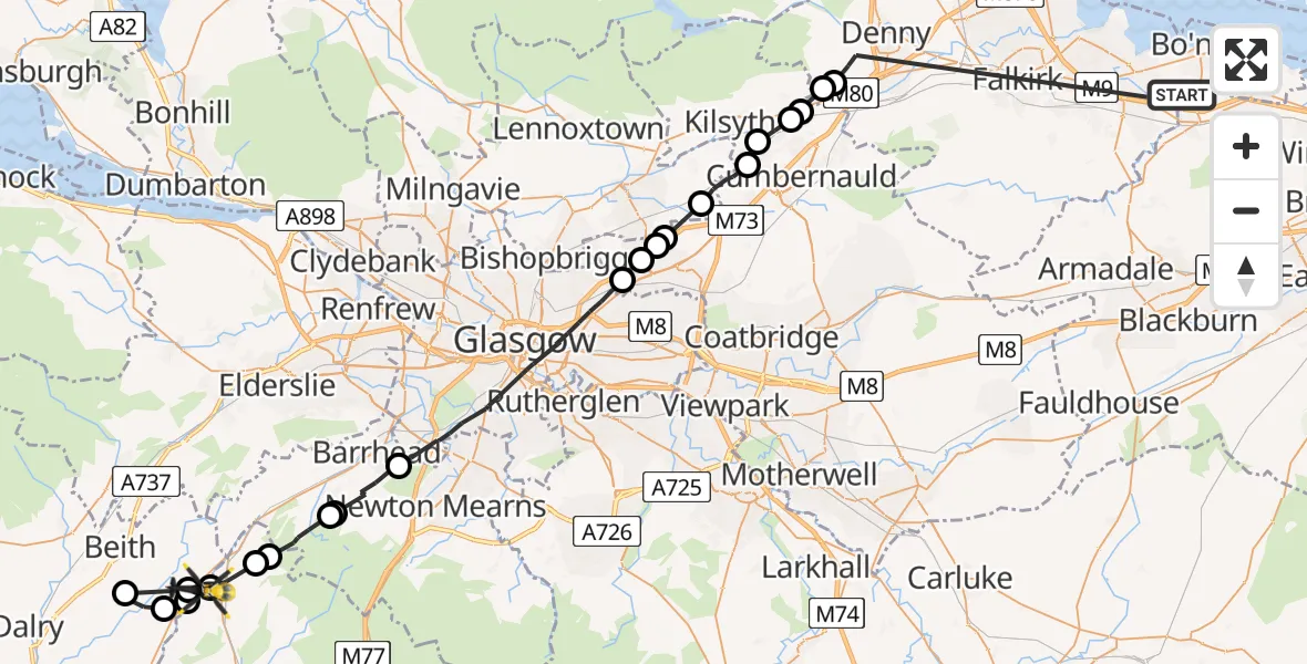
On Friday, 13 February 2026 at 18:00, a Police Helicopter departed from Bo'ness to Burnhouse. It was the Police Helicopter with registration number G-PSHU. The flight lasted 22 minutes. During that period, the aircraft travelled 51 miles at an average speed of 142 miles per hour at a maximum altitude of 3175 feet.
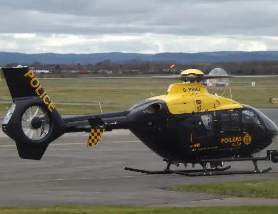
Helicopter: G-PSHU
The helicopter G-PSHU is used by the British police. The helicopter is deployed in pursuits, missing persons cases and other incidents where a helicopter provides added value.
Photo: James from Cheltenham, Gloucestershire
52 miles
3175 feet
142 mph
22 minutes
18:00
18:22

Route
Lochlibo Road, 18:22
Burnhouse18:21
Beith18:20
Barrmill18:19
Burnhouse18:19
Dunlop18:18
Lugton18:18
Hazelbank Farm18:17
Neilston18:16
Gateside18:16
Barrhead18:15
Glasgow18:10
Stepps18:10
Auchinloch18:09
Moodiesburn18:09
Langmuir18:08
Cumbernauld18:07
Auchinstarry18:07
Dullatur18:06
Banton18:06
Coneypark18:06
Banknock18:05
Bo'ness, 18:00
Live flights
Today
Police Helicopter to Epping Forest, Green Lane26 Feb 23:43
Flights Burnhouse
Police Helicopter to Burnhouse, Lochlibo Road13 Feb 18:00
Helicopter flights on your website?
You can easily display helicopter flights on your own website. Use the embed code.
