Air Ambulance Helicopter to North Boarhunt, North Boarhunt
Friday, 13 February 2026 | 13:47 | From Test Valley
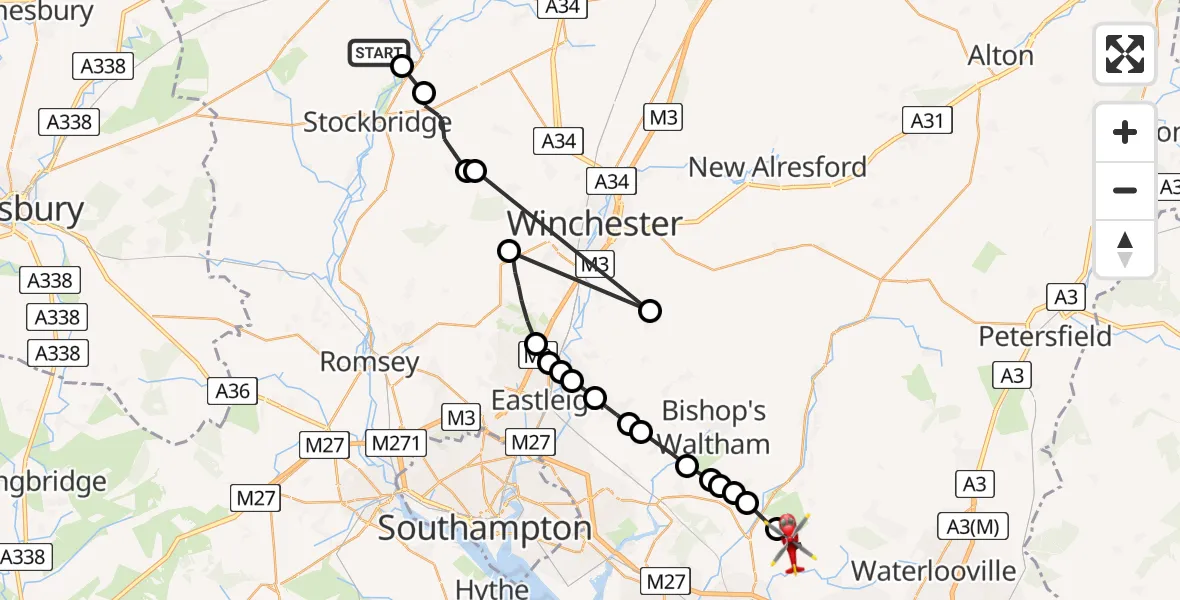
On Friday, 13 February 2026 at 13:47, a Air Ambulance Helicopter departed from Test Valley to North Boarhunt. It was the Air Ambulance Helicopter with registration number G-HIOW. The flight lasted 13 minutes. During that period, the aircraft travelled 37 miles at an average speed of 170 miles per hour at a maximum altitude of 1725 feet.
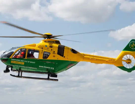
Helicopter: G-HIOW
The helicopter G-HIOW is used as a air ambulance helicopter. The main purpose of this aircraft is to transport a Mobile Medical Team to an incident as quickly as possible, enabling the trauma doctor to provide immediate first aid on site. The aircraft is flying this flight as Air Ambulance Helicopter.
Photo: JF2608
38 miles
1725 feet
170 mph
14 minutes
13:47
14:00

Route
North Boarhunt, Winchester14:00
North Boarhunt, Winchester13:58
Wickham, Winchester13:57
Shirrell Heath, Southampton13:57
Shedfield, Winchester13:56
Waltham Chase, Winchester13:56
Curdridge, Winchester13:56
Durley, Winchester13:55
Horton Heath, Eastleigh13:54
Fair Oak, Eastleigh13:54
Bishopstoke, Eastleigh13:53
Highbridge, Winchester13:53
Allbrook, Eastleigh13:53
Allbrook, Chandler's Ford13:52
Hursley, Winchester13:51
Owslebury, Winchester13:50
Sparsholt, Winchester13:50
King's Somborne, Test Valley13:49
Test Valley13:48
Longstock, Test Valley13:47
Longstock Road, 13:47
Live flights
Today
Police Helicopter to Epping Forest, Green Lane26 Feb 23:43
Helicopter flights on your website?
You can easily display helicopter flights on your own website. Use the embed code.
