Air Ambulance Helicopter to Poole, Whitecliff Road
Friday, 13 February 2026 | 12:57 | From Poole
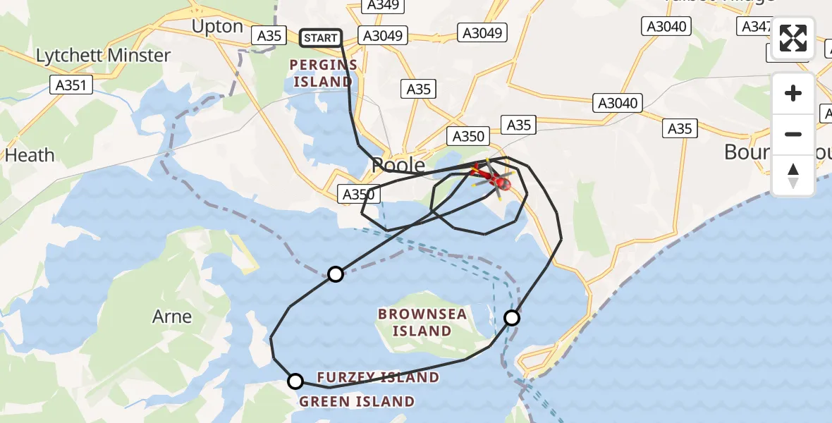
On Friday, 13 February 2026 at 12:57, a Air Ambulance Helicopter departed from Poole to Poole. It was the Air Ambulance Helicopter with registration number G-DSAA. The flight lasted 15 minutes. During that period, the aircraft travelled 19 miles at an average speed of 74 miles per hour at a maximum altitude of 1550 feet.
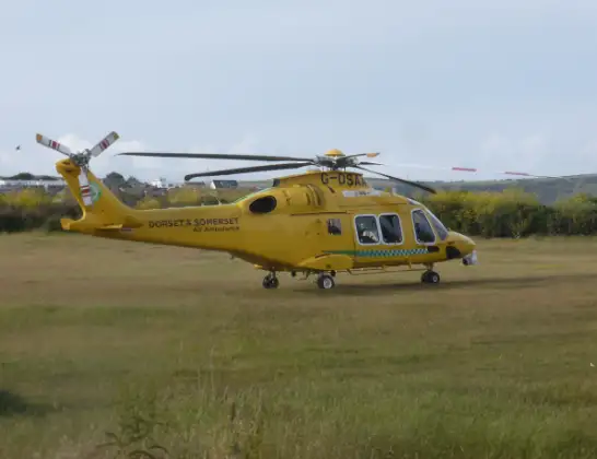
Helicopter: G-DSAA
The helicopter G-DSAA is used as a air ambulance helicopter. The main purpose of this aircraft is to transport a Mobile Medical Team to an incident as quickly as possible, enabling the trauma doctor to provide immediate first aid on site. The aircraft is flying this flight as Air Ambulance Helicopter.
Photo: Andrew Bone
19 miles
1550 feet
74 mph
16 minutes
12:57
13:13

Route
Whitecliff Road, 13:13
Poole13:08
Corfe Castle13:06
Studland13:05
Holes Bay Road, 12:58
Poole12:57
Live flights
Today
Flights Poole
Coastguard Helicopter to Poole, Whitecliff Road28 Jun 12:47
Coastguard Helicopter to Poole, Whitecliff Road28 Jun 12:05
Coastguard Helicopter to Poole, Whitecliff Road28 Jun 11:46
Coastguard Helicopter to Poole, Whitecliff Road28 Jun 11:07
Coastguard Helicopter to Solent Airport30 May 21:16
Helicopter flights on your website?
You can easily display helicopter flights on your own website. Use the embed code.
