Air Ambulance Helicopter to Glasgow Airport
Friday, 13 February 2026 | 8:18 | From Glasgow Airport
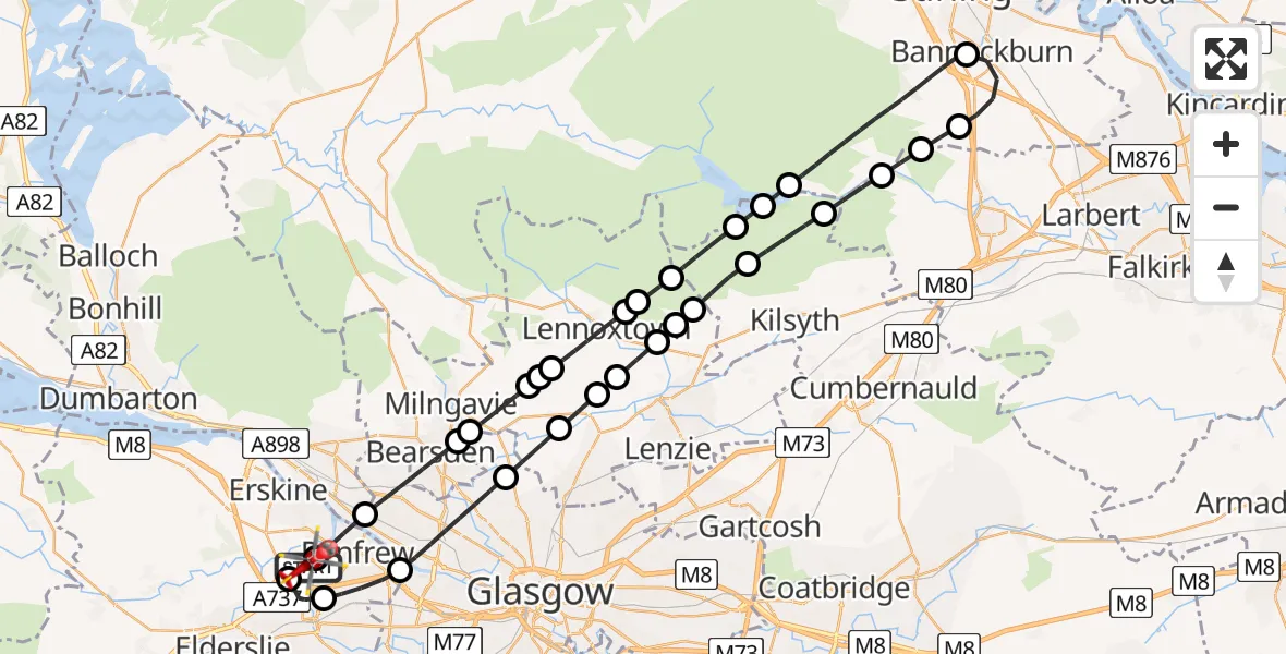
On Friday, 13 February 2026 at 8:18, a Air Ambulance Helicopter departed from Glasgow Airport to Glasgow Airport. It was the Air Ambulance Helicopter with registration number G-ISAS. The flight lasted 25 minutes. During that period, the aircraft travelled 53 miles at an average speed of 127 miles per hour at a maximum altitude of 2900 feet.
Helicopter: G-ISAS
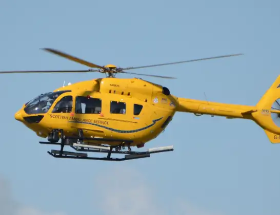
The helicopter G-ISAS is used as a air ambulance helicopter. The main purpose of this aircraft is to transport a Mobile Medical Team to an incident as quickly as possible, enabling the trauma doctor to provide immediate first aid on site. The aircraft is flying this flight as Air Ambulance Helicopter.
Photo: Jonathan Payne
54 miles
2900 feet
127 mph
26 minutes
08:18
08:43

Route
Glasgow Airport, Glasgow08:43
Glasgow Airport, Glasgow08:42
Paisley08:41
Renfrew08:40
Glasgow08:38
Bishopbriggs08:38
Torrance08:37
Lennoxtown08:37
Milton of Campsie08:36
Kirkintilloch08:36
Milton of Campsie08:36
Queenzieburn08:35
Kilsyth08:34
Fankerton08:33
Bannockburn08:33
Stirling08:32
Bannockburn08:31
Stirling08:28
Carron Valley Reservoir08:27
Kilsyth08:27
Milton of Campsie08:26
Lennoxtown08:25
Clachan of Campsie08:25
Lennoxtown08:23
Glasgow08:23
Torrance08:23
Milngavie08:21
Bearsden08:21
Glasgow08:19
Netherton Avenue, 08:18
Renfrew08:18
Glasgow Airport, Glasgow08:18
Live flights
Today
Helicopter flights on your website?
You can easily display helicopter flights on your own website. Use the embed code.
