Police Helicopter to South Nutfield, Coopers Hill Road
Friday, 13 February 2026 | 2:25 | From Worthing
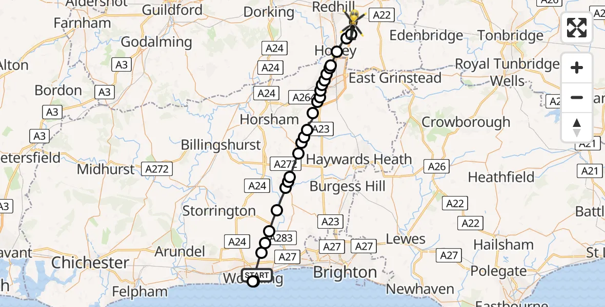
On Friday, 13 February 2026 at 2:25, a Police Helicopter departed from Worthing to South Nutfield. It was the Police Helicopter with registration number G-POLH. The flight lasted 16 minutes. During that period, the aircraft travelled 33 miles at an average speed of 123 miles per hour at a maximum altitude of 2200 feet.
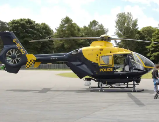
Helicopter: G-POLH
The helicopter G-POLH is used by the British police. The helicopter is deployed in pursuits, missing persons cases and other incidents where a helicopter provides added value.
Photo: Arpingstone
33 miles
2200 feet
123 mph
17 minutes
02:25
02:41

Route
Coopers Hill Road, 02:41
Outwood02:40
Smallfield02:40
Horley, Reigate and Banstead02:39
London Gatwick Airport, London02:39
Tinsley Green, Crawley02:39
Manor Royal, Crawley02:38
Langley Green, Crawley02:38
West Green, Crawley02:38
Southgate, Crawley02:38
Broadfield, Crawley02:37
Colgate, Crawley02:37
Colgate, Horsham02:37
Horsham02:36
Warninglid, Horsham02:36
Slaugham, Mid Sussex02:35
Crabtree, Horsham02:35
Cowfold, Horsham02:34
Horsham02:34
Partridge Green, Horsham02:33
Henfield, Horsham02:32
Steyning02:31
Bramber, Horsham02:31
Sompting, Adur02:30
Worthing02:26
English Channel02:26
Cranworth Road, 02:25
Live flights
Today
Flights Worthing
Air Ambulance Helicopter to Redhill Aerodrome23 Jun 21:42
Police Helicopter to Lancing, Brighton Road4 Jun 10:33
Helicopter flights on your website?
You can easily display helicopter flights on your own website. Use the embed code.
