Air Ambulance Helicopter to Bridgwater, Lime Tree Close
Thursday, 12 February 2026 | 20:10 | From Henstridge Airfield
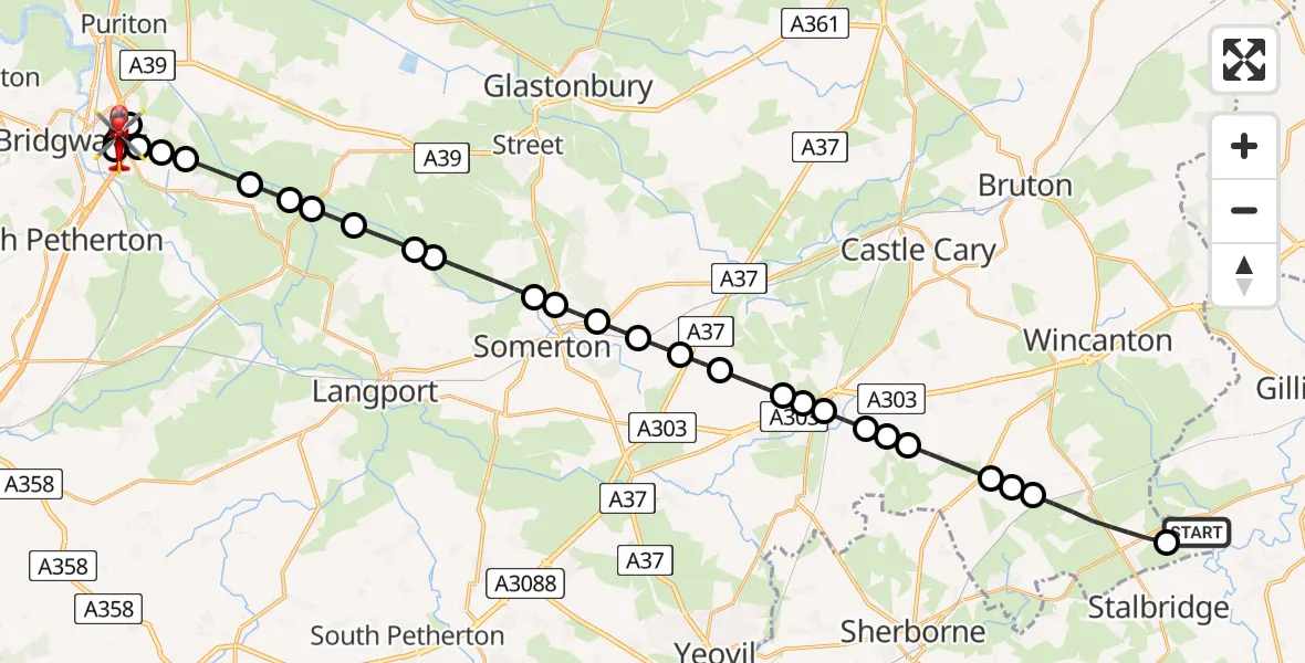
On Thursday, 12 February 2026 at 20:10, a Air Ambulance Helicopter departed from Henstridge Airfield to Bridgwater. It was the Air Ambulance Helicopter with registration number G-DSAA. The flight lasted 22 minutes. During that period, the aircraft travelled 32 miles at an average speed of 89 miles per hour at a maximum altitude of 1950 feet.
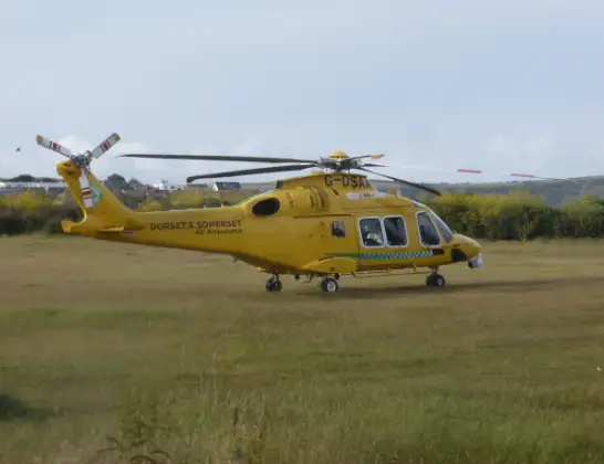
Helicopter: G-DSAA
The helicopter G-DSAA is used as a air ambulance helicopter. The main purpose of this aircraft is to transport a Mobile Medical Team to an incident as quickly as possible, enabling the trauma doctor to provide immediate first aid on site. The aircraft is flying this flight as Air Ambulance Helicopter.
Photo: Andrew Bone
33 miles
1950 feet
89 mph
22 minutes
20:10
20:32

Route
Bridgwater20:32
Lime Tree Close, 20:31
Lime Tree Close, 20:30
Bridgwater20:28
Dunwear20:28
Bridgwater20:27
Dunwear20:27
Westonzoyland20:27
Chedzoy20:27
Westonzoyland20:26
Moorlinch20:25
Middlezoy20:25
Aller20:25
High Ham20:24
Pitney20:24
Somerton20:22
Littleton20:22
Somerton20:22
Charlton Mackrell20:21
Charlton Adam20:21
Babcary20:20
West Camel20:19
Queen Camel20:19
Sparkford20:19
Weston Bampfylde20:18
Sutton Montis20:18
Corton Denham20:18
Charlton Horethorne20:17
Stowell20:17
Horsington20:16
Henstridge20:15
Henstridge Airfield, Templecombe, Somerset20:14
Henstridge Airfield, Templecombe, Somerset20:10
Live flights
Today
Flights Bridgwater
Air Ambulance Helicopter to Musgrove Hospital13 May 22:58
Air Ambulance Helicopter to Musgrove Hospital13 May 08:42
Helicopter flights on your website?
You can easily display helicopter flights on your own website. Use the embed code.
