Air Ambulance Helicopter to Tornagrain
Thursday, 12 February 2026 | 18:38 | From Inverness
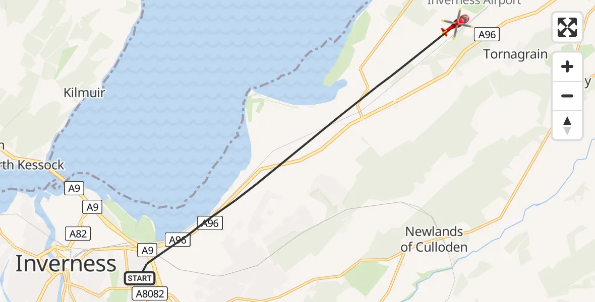
On Thursday, 12 February 2026 at 18:38, a Air Ambulance Helicopter departed from Inverness to Tornagrain. It was the Air Ambulance Helicopter with registration number G-GSAS. The flight lasted 4 minutes. During that period, the aircraft travelled 6 miles at an average speed of 97 miles per hour at a maximum altitude of 1375 feet.
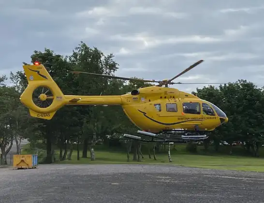
Helicopter: G-GSAS
The helicopter G-GSAS is used as a air ambulance helicopter. The main purpose of this aircraft is to transport a Mobile Medical Team to an incident as quickly as possible, enabling the trauma doctor to provide immediate first aid on site. The aircraft is flying this flight as Air Ambulance Helicopter.
Photo: Scanbus
7 miles
1375 feet
97 mph
4 minutes
18:38
18:42

Route
Tornagrain, 18:42
Raigmore Gardens, 18:38
Live flights
Today
Flights Tornagrain
Air Ambulance Aircraft to RAF Lossiemouth5 Jul 23:17
Air Ambulance Helicopter to Tornagrain19 Jun 13:24
Air Ambulance Helicopter to Tornagrain, A9611 Jun 18:42
Coastguard Helicopter to Inverness Airport10 Jun 11:37
Air Ambulance Helicopter to Tornagrain7 Jun 14:03
Air Ambulance Helicopter to Tornagrain3 Jun 20:44
Air Ambulance Helicopter to Tornagrain, A9629 May 17:18
Air Ambulance Helicopter to Tornagrain26 Apr 05:46
Flights Inverness
Air Ambulance Helicopter to Inverness13 Jul 17:28
Coastguard Helicopter to Inverness Airport13 Jul 15:18
Coastguard Helicopter to Coire Sgreamhach12 Jul 17:55
Helicopter flights on your website?
You can easily display helicopter flights on your own website. Use the embed code.
