Police Helicopter to Exeter International Airport
Thursday, 12 February 2026 | 16:28 | From Liverton Coldeast
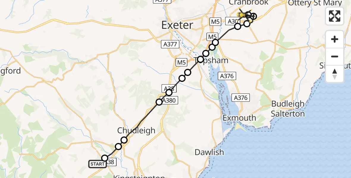
On Thursday, 12 February 2026 at 16:28, a Police Helicopter departed from Liverton Coldeast to Exeter International Airport. It was the Police Helicopter with registration number G-CPAS. The flight lasted 7 minutes. During that period, the aircraft travelled 18 miles at an average speed of 154 miles per hour at a maximum altitude of 2350 feet.

Helicopter: G-CPAS
The helicopter G-CPAS is used by the British police. The helicopter is deployed in pursuits, missing persons cases and other incidents where a helicopter provides added value.
Photo: Tony Melony
18 miles
2350 feet
154 mph
7 minutes
16:28
16:35

Route
Exeter International Airport, Exeter, Devon16:35
Exeter International Airport, Exeter, Devon16:35
Rockbeare, East Devon16:35
Aylesbeare, East Devon16:35
East Devon, Devon and Torbay16:34
Clyst St Mary, East Devon16:33
Clyst St. George, Topsham16:33
Topsham, Exeter16:33
Exminster, Topsham16:33
Exminster, Teignbridge16:32
Kennford, Teignbridge16:32
Kenn, Teignbridge16:31
Teignbridge, Devon and Torbay16:31
Chudleigh, Teignbridge16:30
Chudleigh Knighton, Teignbridge16:29
Heathfield, Teignbridge16:29
Old Liverton Road, Teignbridge16:28
Live flights
Today
Police Helicopter to Falkirk02:12:08
Helicopter flights on your website?
You can easily display helicopter flights on your own website. Use the embed code.
