Air Ambulance Helicopter to Springfield Farm Airstrip, Springfield Farm Airstrip
Thursday, 12 February 2026 | 9:19 | From Coventry Airport
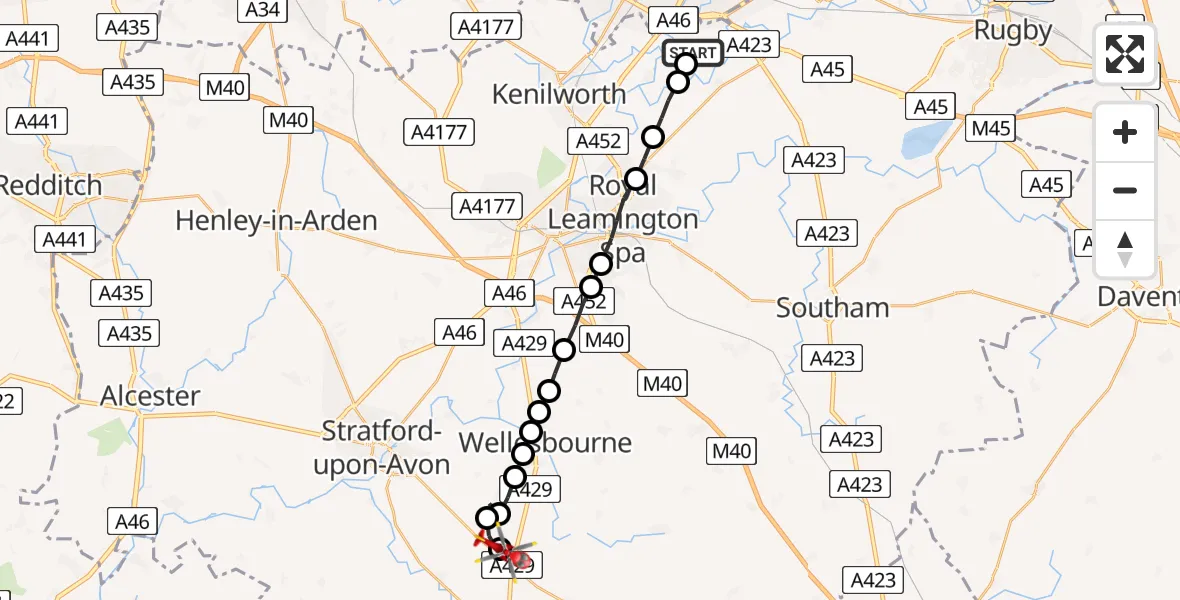
On Thursday, 12 February 2026 at 9:19, a Air Ambulance Helicopter departed from Coventry Airport to Springfield Farm Airstrip. It was the Air Ambulance Helicopter with registration number G-WNAS. The flight lasted 8 minutes. During that period, the aircraft travelled 17 miles at an average speed of 125 miles per hour at a maximum altitude of 2225 feet.
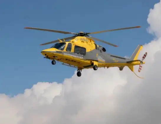
Helicopter: G-WNAS
The helicopter G-WNAS is used as an ambulance helicopter. The helicopter is equipped with a stretcher for transporting patients. The helicopter is often used to transport to hospitals.
Photo: Tony Melony
18 miles
2225 feet
125 mph
9 minutes
09:19
09:27

Route
Springfield Farm Airstrip, Ettington09:27
Springfield Farm Airstrip, Ettington09:27
Alderminster CP, Stratford-on-Avon09:25
Stratford-on-Avon09:24
Wellesbourne, Stratford-on-Avon09:24
Wellesbourne Mountford Airfield, Warwick, Warwickshire09:24
Charlecote, Stratford-on-Avon09:23
Wellesbourne, Stratford-on-Avon09:23
Charlecote, Stratford-on-Avon09:23
Wasperton, Warwick09:22
Bishop's Tachbrook, Warwick09:22
Warwick09:21
Royal Leamington Spa09:20
Cubbington, Warwick09:20
Stoneleigh, Warwick09:19
Baginton, Warwick09:19
Coventry Airport, Coventry, West Midlands09:19
Live flights
Today
Helicopter flights on your website?
You can easily display helicopter flights on your own website. Use the embed code.
