Police Helicopter to Bournemouth Airport, Bournemouth Airport
Wednesday, 11 February 2026 | 23:48 | From Bournemouth Airport
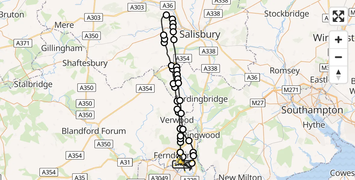
On Wednesday, 11 February 2026 at 23:48, a Police Helicopter departed from Bournemouth Airport to Bournemouth Airport. It was the Police Helicopter with registration number G-CPAO. The flight lasted 22 minutes. During that period, the aircraft travelled 49 miles at an average speed of 135 miles per hour at a maximum altitude of 4025 feet.
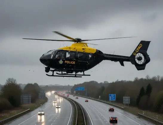
Helicopter: G-CPAO
The helicopter G-CPAO is used by the British police. The helicopter is deployed in pursuits, missing persons cases and other incidents where a helicopter provides added value.
Photo: Tony Melony
49 miles
4025 feet
135 mph
22 minutes
23:48
00:09

Route
Bournemouth Airport, Bournemouth00:09
Bournemouth Airport, Bournemouth00:09
Hurn00:08
St. Leonards and St. Ives00:08
St Leonards00:07
Ashley Heath00:06
Verwood00:05
Alderholt00:05
Damerham, New Forest00:04
New Forest00:03
Rockbourne, New Forest00:03
Coombe Bissett00:03
New Forest00:03
Bishopstone00:01
Wilton00:01
Burcombe00:00
South Newton00:00
Barford St. Martin00:00
Great Wishford23:59
Barford St. Martin23:58
Bishopstone23:57
Broad Chalke23:57
Bishopstone23:55
New Forest23:55
Martin, New Forest23:54
New Forest23:53
Damerham, New Forest23:52
Alderholt23:52
Edmondsham23:52
Verwood23:50
Three Legged Cross, Verwood23:50
Verwood23:50
West Moors23:49
Ferndown23:49
Hurn23:48
Parley Cross23:48
Hurn23:48
Bournemouth Airport, Bournemouth23:48
Live flights
Today
Helicopter flights on your website?
You can easily display helicopter flights on your own website. Use the embed code.
