Air Ambulance Helicopter to City of Nottingham, Dickinson Street
Wednesday, 11 February 2026 | 16:53 | From Widmerpool
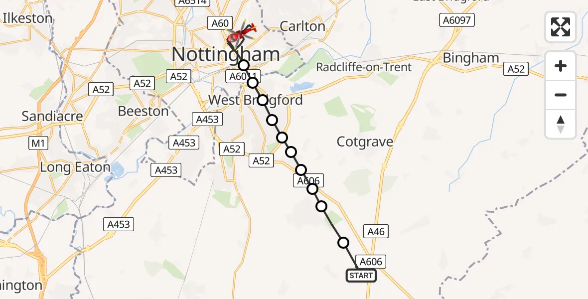
On Wednesday, 11 February 2026 at 16:53, a Air Ambulance Helicopter departed from Widmerpool to City of Nottingham. It was the Air Ambulance Helicopter with registration number G-DRLA. The flight lasted 7 minutes. During that period, the aircraft travelled 12 miles at an average speed of 107 miles per hour at a maximum altitude of 2200 feet.
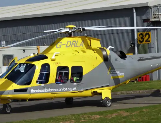
Helicopter: G-DRLA
The helicopter G-DRLA is used as an ambulance helicopter. The helicopter is equipped with a stretcher for transporting patients. The helicopter is often used to transport to hospitals.
Photo: Alec Wilson
13 miles
2200 feet
107 mph
7 minutes
16:53
16:59

Route
Dickinson Street, East Midlands16:59
City of Nottingham, East Midlands16:56
West Bridgford, City of Nottingham16:55
West Bridgford, Rushcliffe16:55
West Bridgford, City of Nottingham16:55
West Bridgford, Rushcliffe16:55
Tollerton, West Bridgford16:54
Plumtree, Rushcliffe16:54
Normanton on the Wolds, Rushcliffe16:54
Keyworth, Rushcliffe16:54
Stanton on the Wolds, Rushcliffe16:53
Widmerpool, Rushcliffe16:53
Live flights
Today
Police Helicopter to Connah's Quay28 May 23:33
Air Ambulance Helicopter to Nottingham Heliport28 May 23:32
Air Ambulance Aircraft to Glasgow Airport28 May 23:31
Air Ambulance Helicopter to Redhill Aerodrome28 May 23:29
Air Ambulance Helicopter to Southampton Airport28 May 23:28
Police Helicopter to North Weald Airfield28 May 22:46
Flights Widmerpool
Air Ambulance Helicopter to Buxton, Green Lane27 May 16:32
Air Ambulance Helicopter to Nottingham Heliport26 May 06:46
Air Ambulance Helicopter to Nottingham Heliport24 May 20:33
Air Ambulance Helicopter to Nottingham Heliport24 May 18:50
Helicopter flights on your website?
You can easily display helicopter flights on your own website. Use the embed code.
