Air Ambulance Helicopter to Kidlington, Banbury Road
Wednesday, 11 February 2026 | 10:07 | From Kidlington
On Wednesday, 11 February 2026 at 10:07, a Air Ambulance Helicopter departed from Kidlington to Kidlington. It was the Air Ambulance Helicopter with registration number G-DAAN. The flight lasted 12 minutes. During that period, the aircraft travelled 24 miles at an average speed of 122 miles per hour at a maximum altitude of 1925 feet.
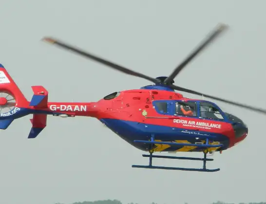
Helicopter: G-DAAN
The helicopter G-DAAN is used as a air ambulance helicopter. The main purpose of this aircraft is to transport a Mobile Medical Team to an incident as quickly as possible, enabling the trauma doctor to provide immediate first aid on site. The aircraft is flying this flight as Air Ambulance Helicopter.
Photo: MilborneOne
25 miles
1925 feet
122 mph
12 minutes
10:07
10:19

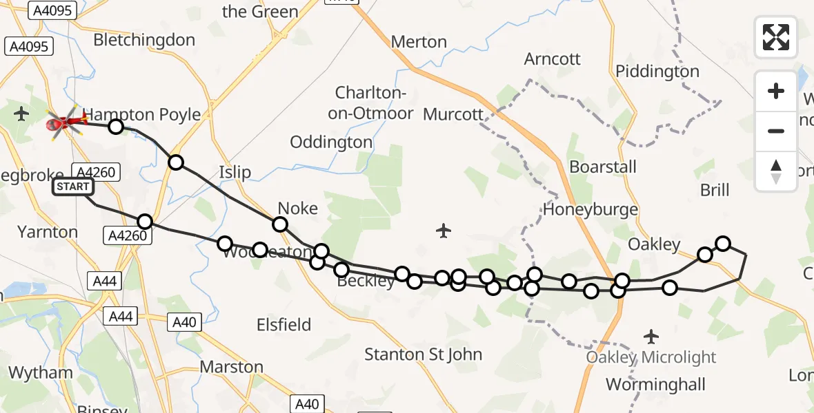
Route
Banbury Road, Cherwell10:19
Kidlington, Cherwell10:19
Hampton Poyle, Cherwell10:18
Islip, Cherwell10:17
Noke, Cherwell10:17
Beckley, South Oxfordshire10:16
Stanton St John, South Oxfordshire10:16
Horton-cum-Studley, Cherwell10:15
Horton-cum-Studley, Oxford10:15
Horton-cum-Studley, South Oxfordshire10:15
Horton-cum-Studley, Cherwell10:15
Oakley10:14
Honeyburge10:14
Oakley10:13
Brill10:13
Oakley10:12
Honeyburge10:12
Oakley10:11
Horton-cum-Studley, Cherwell10:11
Horton-cum-Studley, Oxford10:11
Horton-cum-Studley, Cherwell10:11
Stanton St John, South Oxfordshire10:10
Beckley, South Oxfordshire10:10
Noke, Cherwell10:10
Woodeaton, Oxford10:09
Woodeaton, South Oxfordshire10:09
Cherwell10:08
Andersons Close, Cherwell10:07
Live flights
Today
Flights Kidlington
Police Helicopter to Kidlington, Woodstock Road10 Jul 14:44
Air Ambulance Helicopter to Oxford, Headley Way10 Jun 12:19
Police Helicopter to Kidlington, Canal Road8 Jun 10:49
Police Helicopter to North Weald Airfield29 Apr 15:18
Police Helicopter to Kidlington, Bladon24 Apr 13:38
Helicopter flights on your website?
You can easily display helicopter flights on your own website. Use the embed code.
