Police Helicopter to Metropolitan Police Air Support Unit Lippitts Hill, Metropolitan Police Air Support Unit Lippitts Hill
Tuesday, 10 February 2026 | 15:23 | From Aldenham
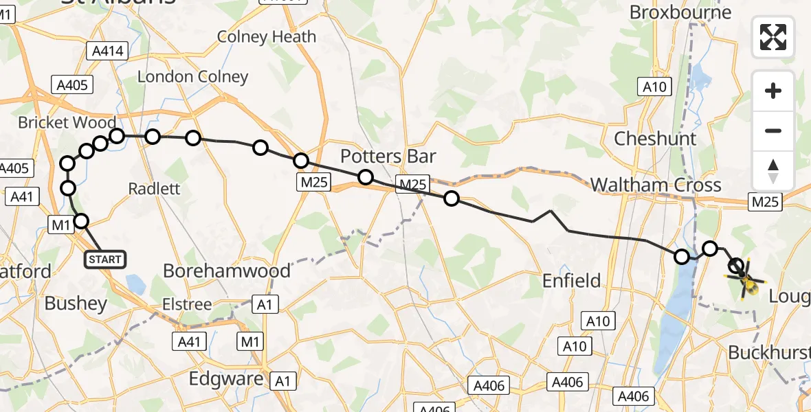
On Tuesday, 10 February 2026 at 15:23, a Police Helicopter departed from Aldenham to Metropolitan Police Air Support Unit Lippitts Hill. It was the Police Helicopter with registration number G-MPSC. The flight lasted 10 minutes. During that period, the aircraft travelled 20 miles at an average speed of 125 miles per hour at a maximum altitude of 1825 feet.
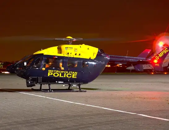
Helicopter: G-MPSC
The helicopter G-MPSC is used by the British police. The helicopter is deployed in pursuits, missing persons cases and other incidents where a helicopter provides added value.
Photo: aceebee, Camberley, UK
21 miles
1825 feet
125 mph
10 minutes
15:23
15:33

Route
Metropolitan Police Air Support Unit Lippitts Hill, Loughton, Essex15:33
Sewardstonebury, Epping Forest15:33
Epping Forest, Essex15:32
King George V Reservoir15:32
London Borough of Enfield, Greater London15:29
Potters Bar, Hertsmere15:28
South Mimms, Hertsmere15:28
Ridge, Hertsmere15:27
Shenley, Hertsmere15:26
St Albans15:26
Frogmore, St Albans15:25
Bricket Wood, St Albans15:25
Aldenham, Hertsmere15:25
St Albans15:25
Aldenham, Hertsmere15:24
Aldenham, Watford15:24
Hilfield Lane, Hertsmere15:23
Today
Police Helicopter to Epping Forest, Green Lane26 Feb 23:43
Flights Aldenham
Helicopter flights on your website?
You can easily display helicopter flights on your own website. Use the embed code.
