Air Ambulance Helicopter to Caernarfon Airport, Caernarfon Airport
Tuesday, 10 February 2026 | 14:26 | From Llandudno
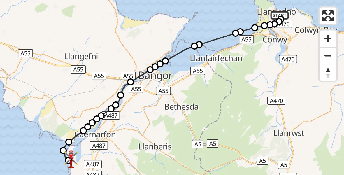
On Tuesday, 10 February 2026 at 14:26, a Air Ambulance Helicopter departed from Llandudno to Caernarfon Airport. It was the Air Ambulance Helicopter with registration number G-LOYW. The flight lasted 16 minutes. During that period, the aircraft travelled 29 miles at an average speed of 109 miles per hour at a maximum altitude of 2050 feet.
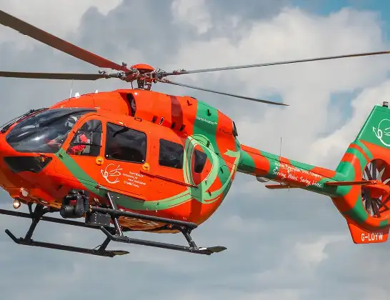
Helicopter: G-LOYW
The helicopter G-LOYW is used as a air ambulance helicopter. The main purpose of this aircraft is to transport a Mobile Medical Team to an incident as quickly as possible, enabling the trauma doctor to provide immediate first aid on site. The aircraft is flying this flight as Air Ambulance Helicopter.
Photo: Sarahpurpleface
30 miles
2050 feet
109 mph
17 minutes
14:26
14:42

Route
Caernarfon Airport, Caernarfon14:42
Caernarfon Airport, Caernarfon14:41
Caernarfon Airport, Caernarfon14:40
Dinas Dinlle14:39
Pen-Lôn14:38
Rhosyr14:38
Bontnewydd14:37
Rhosyr14:37
Llanidan14:37
Y Felinheli14:37
Brynsiencyn14:36
Llanddaniel Fab14:36
Y Felinheli14:35
Llanfairpwllgwyngyll14:35
Menai Bridge14:34
Beaumaris14:33
Bangor14:33
Llandygai14:33
Aber14:31
Abergwyngregyn14:31
Penmaenmawr14:29
Dwygyfylchi14:29
Penmaenmawr14:28
Conwy Marina Village, Conwy14:28
Llanrhos, Llandudno14:27
Deganwy, Conwy14:27
Hill View Court, Conwy14:27
Llanrhos, Llandudno14:27
Llandudno14:26
Live flights
Today
Flights Llandudno
Coastguard Helicopter to Llandudno, Marine Drive10 Feb 18:39
Helicopter flights on your website?
You can easily display helicopter flights on your own website. Use the embed code.
