Air Ambulance Helicopter to Worcester Park Estate, Gore Road
Saturday, 7 February 2026 | 13:38 | From Rochester Airport
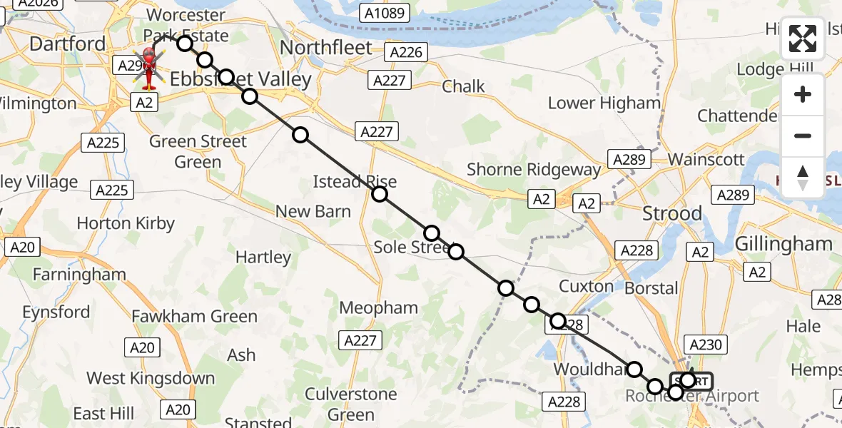
On Saturday, 7 February 2026 at 13:38, a Air Ambulance Helicopter departed from Rochester Airport to Worcester Park Estate. It was the Air Ambulance Helicopter with registration number G-NICU. The flight lasted 11 minutes. During that period, the aircraft travelled 14 miles at an average speed of 74 miles per hour at a maximum altitude of 1550 feet.
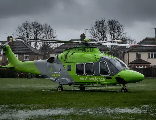
Helicopter: G-NICU
The helicopter G-NICU is used as an ambulance helicopter. The helicopter is equipped with a stretcher for transporting patients. The helicopter is often used to transport to hospitals.
Photo: Tony Melony
15 miles
1550 feet
74 mph
12 minutes
13:38
13:49

Route
Worcester Park Estate, Dartford13:49
Gore Road, Dartford13:49
Worcester Park Estate, Dartford13:46
Ashmere, Ebbsfleet Garden City13:46
Alkerden, Ebbsfleet Garden City13:46
Alkerden, Dartford13:45
Southfleet, Dartford13:45
Northfleet, Gravesham13:44
Sole Street, Gravesham13:44
Cobham, Gravesham13:43
Luddesdown, Gravesham13:43
Cuxton13:43
Rochester13:42
Wouldham, Tonbridge and Malling13:42
Burham, Tonbridge and Malling13:41
Bluebell Hill, Chatham13:41
Tonbridge and Malling13:41
Rochester Airport, Rochester, Kent13:40
Rochester Airport, Rochester, Kent13:38
Live flights
Today
Police Helicopter to Epping Forest, Green Lane26 Feb 23:43
Helicopter flights on your website?
You can easily display helicopter flights on your own website. Use the embed code.
