Air Ambulance Helicopter to Rochester Airport
Saturday, 7 February 2026 | 13:17 | From Darent Valley Hospital
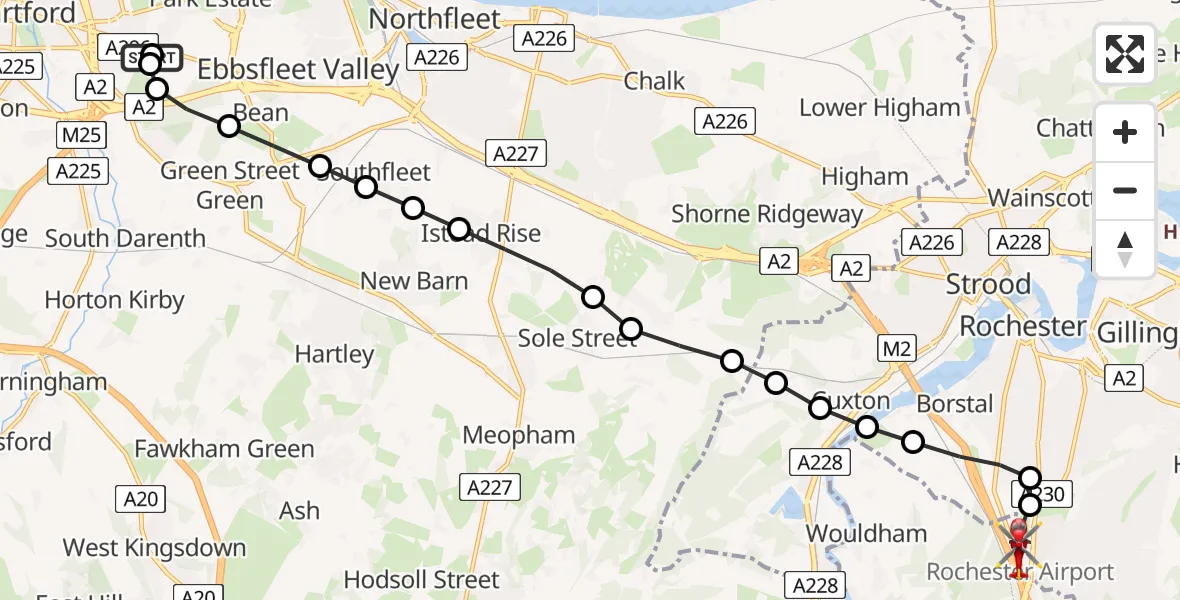
On Saturday, 7 February 2026 at 13:17, a Air Ambulance Helicopter departed from Darent Valley Hospital to Rochester Airport. It was the Air Ambulance Helicopter with registration number G-NICU. The flight lasted 9 minutes. During that period, the aircraft travelled 13 miles at an average speed of 86 miles per hour at a maximum altitude of 1550 feet.
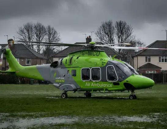
Helicopter: G-NICU
The helicopter G-NICU is used as an ambulance helicopter. The helicopter is equipped with a stretcher for transporting patients. The helicopter is often used to transport to hospitals.
Photo: Tony Melony
14 miles
1550 feet
86 mph
10 minutes
13:17
13:26

Route
Rochester Airport, Rochester, Kent13:26
Rochester Airport, Rochester, Kent13:26
Rochester Airport, Rochester, Kent13:24
Rochester13:24
Borstal, Rochester13:23
Cuxton13:23
Rochester13:23
Cuxton13:23
Luddesdown, Gravesham13:22
Cobham, Gravesham13:22
Sole Street, Gravesham13:22
Northfleet, Gravesham13:21
New Barn, Dartford13:21
Southfleet, Dartford13:20
Longfield, Dartford13:20
Bean, Dartford13:20
Darenth, Dartford13:19
Dartford13:19
Gore Road, Dartford13:18
Worcester Park Estate, Dartford13:17
Darent Valley Hospital, Dartford13:17
Live flights
Police Helicopter on its way from RAF Benson12 Jul 22:54
Police Helicopter on its way from Dundrod12 Jul 22:50
Today
Police Helicopter to East Ardsley, Stoney Lane12 Jul 23:51
Police Helicopter to Birmingham Airport12 Jul 23:46
Air Ambulance Helicopter to Glasgow Airport12 Jul 22:48
Police Helicopter to Walton Wood Airfield12 Jul 22:44
Helicopter flights on your website?
You can easily display helicopter flights on your own website. Use the embed code.
