Air Ambulance Helicopter to Tardebigge, Brockhill Lane
Saturday, 7 February 2026 | 9:53 | From Hill Croome
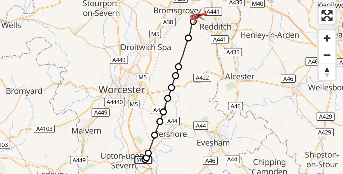
On Saturday, 7 February 2026 at 9:53, a Air Ambulance Helicopter departed from Hill Croome to Tardebigge. It was the Air Ambulance Helicopter with registration number G-OMAA. The flight lasted 11 minutes. During that period, the aircraft travelled 21 miles at an average speed of 115 miles per hour at a maximum altitude of 1675 feet.
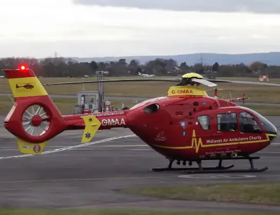
Helicopter: G-OMAA
The helicopter G-OMAA is used as a air ambulance helicopter. The main purpose of this aircraft is to transport a Mobile Medical Team to an incident as quickly as possible, enabling the trauma doctor to provide immediate first aid on site. The aircraft is flying this flight as Air Ambulance Helicopter.
Photo: James from Cheltenham, Gloucestershire
21 miles
1675 feet
115 mph
11 minutes
09:53
10:03

Route
Tardebigge, Bromsgrove10:03
Brockhill Lane, Bromsgrove10:03
Brockhill Lane, Bromsgrove10:02
Brockhill Lane, Bromsgrove10:02
Tardebigge, Bromsgrove10:01
Upper Bentley, Bromsgrove10:00
Hanbury, Wychavon09:58
Himbleton, Wychavon09:58
Wychavon09:57
Upton Snodsbury, Wychavon09:57
Peopleton, Wychavon09:56
Drakes Broughton, Wychavon09:55
Wychavon09:55
Defford, Wychavon09:54
Upper Strensham, Wychavon09:53
M5, Wychavon09:53
Hill Croome, Malvern Hills09:53
Today
Police Helicopter to Epping Forest, Green Lane26 Feb 23:43
Flights Tardebigge
Air Ambulance Helicopter to Hill Croome, M57 Feb 11:04
to Tardebigge, Brockhill Lane7 Feb 10:06
Helicopter flights on your website?
You can easily display helicopter flights on your own website. Use the embed code.
